hewligan
First Post
Map of the southern half of the island
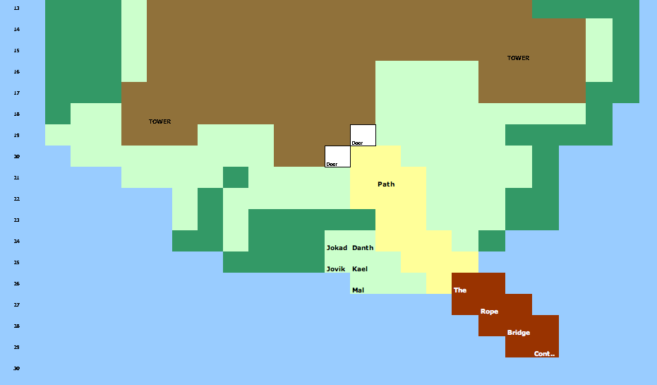
Blue = water (far below)
light green = dirty, short, rather poor looking grass
dark green = thick shrubs, about high and thick enough to hide behind (which is what you are doing)
light brown = the stockade
yellow = a path, more just grass that has been eaten away to stone by many feet
The bridge spans out far to reach the opposite shore.
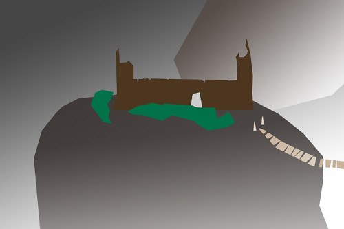
Below is a VERY ROUGH picture I hacked together in a photo editor.
Remember, everything is sort of jerry-rigged wood. The two towers are ramshackle wood, not entirely enclosed (about half way up, after the extend beyond the ground floor of the stockade, they are basically more just beams with visible ladders inside, with additional beams hammered on here and there, with a little platform on top, and a few decorations, such as a reclaimed mast with a totally ruined flag on one, etc.
Blue = water (far below)
light green = dirty, short, rather poor looking grass
dark green = thick shrubs, about high and thick enough to hide behind (which is what you are doing)
light brown = the stockade
yellow = a path, more just grass that has been eaten away to stone by many feet
The bridge spans out far to reach the opposite shore.
Below is a VERY ROUGH picture I hacked together in a photo editor.
Remember, everything is sort of jerry-rigged wood. The two towers are ramshackle wood, not entirely enclosed (about half way up, after the extend beyond the ground floor of the stockade, they are basically more just beams with visible ladders inside, with additional beams hammered on here and there, with a little platform on top, and a few decorations, such as a reclaimed mast with a totally ruined flag on one, etc.
Last edited: