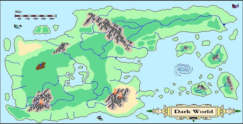
Dark World Maps

Knightfall

World of Kulan DM
Hey all, here is my latest world design. It had a different name at one point by the name made it sound too much like a Conan type world, which it's not.

Dark World is basically that. Evil is everywhere, whether it's drow in the dark forests or orcs raiding from the sea. Evil wizards control dozens of magically inspired cities across the entire planet. Anti-paladins fight blackguards for the right to spread chaos vs. law.

Good characters are rare, but they are often backed up by celestials who have gone native in order to better protect the remaining lands of good. The Great Interior Sea is one of these locales with dozens of good-aligned elves, gnomes, humans, and angels.

Dark World is vile darkness vs. exalted deeds. Neither has won, although evil is ahead. :D
---------------------------------------------------------------------------
Moved intro to new thread: http://www.enworld.org/forum/genera...8-dark-world-good-vs-evil-campaign-world.html

attachment.php
 

Attachments

  • Dark World.jpg
    Dark World.jpg
    105.7 KB · Views: 953
Last edited:

log in or register to remove this ad


Knightfall

World of Kulan DM
Conaill said:
Looks nice.

Uhm... would you like some feedback on the rivers, or did the god of rivers die in this world as well? :p

Feeback is good. I have a tendancy to go nuts with rivers. At least tell me I've got them flowing the right way. Multiple rivers flow out of mountains then join to make bigger rivers. Right? :confused:

Do the rivers meander too much? Go nuts, Conaill. I trust your judgement.

Cheers!

KF72
 
Last edited:

Conaill

First Post
Kewl! "Go nuts", he says. :D

Let's start with the eastermost river on the large continent. See how it flows all along the length of the eastern half of the continent, in between two shorelines? That could only happen if the land between the river and the shorelines to the north and south are *higher* than the river. I.e. you pretty much would have to have mountain chains running aong the N and S coast, with a looong valley in between to channel that river all the way to the E. Given the shape of the continent, it's much more likely that that river would flow out into the N or S ocean closer to the mountain range.

Likewise, there's a river that starts in the NW part of the NW-SE mountain chain, but then curves around and flows into the SE sea. See the area wher it curves around and gets very close to the NW sea? That area must be *higher* than any area further downstream the river, which would typically only happen if there were a mountain range between it and the NW shore. More likely, that branch of the river would flow out into the NW sea.

Ditto with the bottom-most river flowing out of the central southern mountains... It *almost* flows into the S sea, but then curves back N to the central lake. You should probably either cut off that entire, almost circular loop, or have the river flow into the S sea.

How far below sea level is that central lake? You have a number of seas flowing from close to the shore *into* the central lake, implying it may be well below sea level.

Overall, the main rule to keep in mind is that water will find the *shortest* way towards the sea. It may also be a good excercise to draw altitude contour lines on your map. That will tell you rightaway whether your rivers make sense. Indicating river basins, separated by hills or mountain ridges, may be a good idea as well. Another trick is simply to take a world atlas, and find landmarks that look similar to yours... can't beat nature when it comes to designing realistic river beds! ;)
 
Last edited:

Knightfall

World of Kulan DM
Conaill said:
Kewl! "Go nuts", he says. :D

Let's start with the eastermost river on the large continent. See how it flows all along the length of the eastern half of the continent, in between two shorelines? That could only happen if the land between the river and the shorelines to the north and south are *higher* than the river. I.e. you pretty much would have to have mountain chains running aong the N and S coast, with a looong valley in between to channel that river all the way to the E. Given the shape of the continent, it's much more likely that that river would flow out into the N or S ocean closer to the mountain range.

Ok, I see your point. Fixed that, multiple rivers with the closest coastline as the target.

Conaill said:
Likewise, there's a river that starts in the NW part of the NW-SE mountain chain, but then curves around and flows into the SE sea. See the area wher it curves around and gets very close to the NW sea? That area must be *higher* than any area further downstream the river, which would typically only happen if there were a mountain range between it and the NW shore. More likely, that branch of the river would flow out into the NW sea.

Ok, fixed that one. Split it into two different rivers.

Conaill said:
Ditto with the bottom-most river flowing out of the central southern mountains... It *almost* flows into the S sea, but then curves back N to the central lake. You should probably either cut off that entire, almost circular loop, or have the river flow into the S sea.

Ditto.

Conaill said:
How far below sea level is that central lake? You have a number of seas flowing from close to the shore *into* the central lake, implying it may be well below sea level.

Hmm, I like that idea. It is now. Not WAY below sea level but definitely far enough below that the interior rivers flow towards it. It has its dry season, which keep the sea from expanding much further. Flash floods have been known to happen, though.

Conaill said:
Overall, the main rule to keep in mind is that water will find the *shortest* way towards the sea. It may also be a good excercise to draw altitude contour lines on your map. That will tell you rightaway whether your rivers make sense. Indicating river basins, separated by hills or mountain ridges, may be a good idea as well. Another trick is simply to take a world atlas, and find landmarks that look similar to yours... can't beat nature when it comes to designing realistic river beds! ;)

Shortest way, got it. That should help with the rebuilding of another one of my campaign worlds, Time of Ages. As for Dark World, I've added several high area, which are low mountains and high steppe hills, but two different ones are for a large plateau and an impact crater.

The small map is the main area of the what will become any eventual campaign. This is what has been created before but is now being reinterpreted. Hyberiae is what I use to call the world, but it will have a different "world name" now.

Cheers!

KF72

attachment.php


attachment.php
 

Attachments

  • Dark World.jpg
    Dark World.jpg
    105.5 KB · Views: 748
  • Hyberiae Region.jpg
    Hyberiae Region.jpg
    120.4 KB · Views: 708
Last edited:

Knightfall

World of Kulan DM
Hyberiae Peninsula
The Hyberiae Peninsula is a hotbed of conflict. The Ruins of Astinian is where the region's original capital was, but it fell into decadence and was destroyed by a curse from the Gods of Chaos. Due of the curse, the lands of the Hyberiae Peninsula were laid to waste causing the badlands and swamp to form. The swamp is haunted and only the brave or foolish enter it. The Ruins of Astinian are controlled by powerful undead that regularly send their minions against each other and the cities of the peninsula.

The lands around the City of Parch are drier than one would expect with a river flowing through them. This is part of the curse, as well. However, the waters of the river are clear and pristine until it reaches the swamplands. (The river runs through a gorge from when it enters the badlands to when it empties out into the swampland.) Parch is ruled by a council of peers, called the Parched Council, who aren't much better than the warlocks (see below). They control every aspect of the city including who gets access to the river.

The City of Ubaay is the main city in this region and its ruler, a beholder only known as The Orb, considers the entire Hyberiae Peninsula as its dominion. The truth is that the beholder ruler can't control much beyond the Cities of Telay and Ferilian. The beholder is an iron-fisted ruler, which rubs the chaotic denizens of the region the wrong way. They don't care for his ideas about law and order. Two barons control the cities of Telay and Ferilian. Baroness Sayinia of Telay is loyal to the beholder, while Baron Fulk Gutwretch of Ferilian is not.

The other cities on the coast of the Hyberiae Peninsula are chaotic places with a bent towards wickedness. Arcanists, known as Warlocks, control the Cities of Ariskal, Hulay, and Yulia. The Witch of Ariskal, a powerful human (vampire) wizard, is trying to make the undead of the swamplands submit to her. She is the only female and undead ruler in the region but is just as power hungry and cold as the other warlocks.

The Madman of Hulay is mad as a hatter, to say the least. He is a human wizard and often releases dangerous monsters into the city for fun. Hulay is not a safe place and its citizens are forced to live there, as the other options in the region aren't any better. The city pays to keep powerful adventurers around to handle the monsters released by the Warlock Freak, as he is sometimes called (but never to his face). The Madman never gets involved in local politics and the citizens have free reign to live anyway they want.

The Dominator of Yulia is a human wizard/monk who rules his city with an iron fist, much to the annoyance of the city's populace. He is obsessed with finding the broken shards of an ancient magical gem, which is said to grant the possessor the ability to become a god. It is whispered that he has put together nearly half the gem and that his life has been extended by the power it gives him. Those, in the city, that talk to loudly about the gem disappear without a trace.

The Cities of Fort Shore and Fort Sand are the bastions of good in this region. They are the foothold cities of a distant land to the north, past the Low Shores. Travel and trade to and from the north is perilous, but the rich iron, copper and natural glassteel deposits of the Gray Desert and the Turill Gorge are too much to pass up. Governors appointed by the people rule the cities. The governor of Fort Shore is a human rogue/fighter, while the governor of Fort Sand is a dwarf knight.

In the Darkland Mountains are two cities. The City of Fellridge is full of vile, twisted dwarves, while the City of Blackhope is home to righteous dwarves, gray elves, and orcs. The city of Blackhope wishes to align itself with Fort Shore and Fort Sand, but pressure from The Orb has put them off aligning with the two cities.

Two other cities are on the map. The City of Belthi is a dark, vile place where devils walk openly in the street. Half of its citizens are native outsiders such as genies, half-fiends, and a few fallen celestials. Its ruler is a massive, mysterious, unnamed pit fiend who controls the city without question. The city has permanent gates to the Infernal Hells, but they are rarely used anymore, as the devils of the city of Belthi have been forgotten by the Infernal Imperium. The pit fiend likes it that way, as it strengthens its hold on the city. (The denizens of the city worship the pit fiend as a god.)

Opposite of Belthi is the City of Sharis. In Sharis, good rules. A quarter of the city’s citizens are half-celestials, as well as few native angels. Another quarter is made up of elves, half-elves, and a few goodhearted drow. The remaining citizens are human for the most part. An ancient being of epic power known as The Elf Lord rules the city. He is a elf paladin and he has a powerful Council of Patriarchs, made up of celestials and other powerful city natives that help him govern the city and protect The Shining Forest from the machinations of evildoers. The Elf Lord has had contact with The Orb, but the two cannot seem to come to terms for a peace alliance, due to differences in philosophy.

attachment.php
 

Attachments

  • Hyberiae Peninsula.jpg
    Hyberiae Peninsula.jpg
    140.9 KB · Views: 750
Last edited:

Conaill

First Post
Looks a lot better. Well, apart from the river that flows all along the length of the Hyberiae Peninsula, of course. ;)

Another thing to keep in mind: Mountains do not *create* rivers!

It seems like anywhere you have a mountain, you feel the need to have a river starting there. Mountains don't necessarily get any more precipitation than any other spot on your map, so they don't necessarily "generate" rivers (with some exceptions, such as snowcapped mountains or mountains where one side gets much more rainfall than the other due to tradewinds). Mountains do tend to delineate river basins (i.e. the area across which all the rainfall will drain into the same river), and rivers will tend to point away from mountains simply because they flow downhill.

(Note: What is considered the "source" of a river is often fairly arbitrary. When you follow a river uphill, it will branch multiple times, spreading out into a network of little streamlets. Sometimes one of these streamlets is significantly larger than the others, but not necessarily. As close to the mountain peaks as you draw them, they may be less than a feet or two across, while the river may be hundreds of yards wide at it's delta. )
 
Last edited:

Knightfall

World of Kulan DM
Conaill said:
Looks a lot better. Well, apart from the river that flows all along the length of the Hyberiae Peninsula, of course. ;)

Hmm, how did I know you were going to say that. Heh. The river flows into a gorge that travels the length of the peninsula, until it hits the marshlands.

Conaill said:
Another thing to keep in mind: Mountains do not *create* rivers!

Old habits die hard. I'll watch that, thanks.

Conaill said:
It seems like anywhere you have a mountain, you feel the need to have a river starting there. Mountains don't necessarily get any more precipitation than any other spot on your map, so they don't necessarily "generate" rivers (with some exceptions, such as snowcapped mountains or mountains where one side gets much more rainfall than the other due to tradewinds). Mountains do tend to delineate river basins (i.e. the area across which all the rainfall will drain into the same river), and rivers will tend to point away from mountains simply because they flow downhill.

Flowing downhill is what I was doing. BTW, not all of the "brown polygons" are going to be mountains. Some are going to be hilly terrain or something else. Nothing is written in stone, yet. I might end up shrinking some of them or deleteing them if the map doesn't "feel" right.

Conaill said:
(Note: What is considered the "source" of a river is often fairly arbitrary. When you follow a river uphill, it will branch multiple times, spreading out into a network of little streamlets. Sometimes one of these streamlets is significantly larger than the others, but not necessarily. As close to the mountain peaks as you draw them, they may be less than a feet or two across, while the river may be hundreds of yards wide at it's delta. )

That I knew. The map, at the world level can't take that much detail without slowing down the refresh rate in CC2. As I get closer in, there will be those streamlets. Plus, the Hyberiae Peninsula map will likely have more rivers once I decide where I want them to come from.

The long river stays where it is. I like the city above the gorge idea. As for how the gorge was created, who knows. Perhaps a ancient god dropped his sword. :p

But keep the advice coming. It's all good.

Cheers!

KF72


blargney the second

blargney the minute's son
I love your maps, Knightfall! :)

There's just one thing that I have a hard time grokking: the scale. Your continent is almost 10,000 miles long - that's *really* huge! Did the god of distances die in this campaign? ;)

-blarg
 

Remove ads

Top