I draw the occasional D&D map

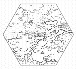
WEB-6-mile-hex-4.jpg

This hex sits to the lower-right of Baraloba and is mostly a forested hex cut through by the road that leads from Baraloba to the distant Citadel on Sabre Lake.

Along the road we run into a few classic items for a D&D game – there’s a large farm near Baraloba itself , a trail leading off to an abandoned logging camp to the north, and finally Strickson’s Auberge, a traveller’s inn roughly 9 miles outside of Baraloba (about three hours travel time). North of Strickson’s Auberge is another of the ancient giant’s towers overlooking the inn and valley, now slowly collapsing.

Southwest of Strickson’s Auberge is a clearing in the woods with a single massive tree at it’s centre. A trail leads deeper into the woods from the tree, probably to another town, or perhaps the base of a small group of humanoids who host their religious activities at the tree.

To see the rest of the hexes in the Baraloba and Environs hexmaps, head over here: https://rpgcharacters.wordpress.com/maps/multi-page-dungeons/baraloba-and-environs/
 

log in or register to remove this ad

6-mile-hex-5.png

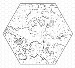
After cutting through the Badlands of Slate, the Hewbank meanders through the slate hills to the east of Baraloba. This stony environment has the Hewbank meander significantly and form into small lakes where small valleys present themselves between the hills.

Another of the old giant watchtowers sits overlooking farmer’s fields on the east side of this area, and another smaller druidic farming community is nestled between forest and lake in the middle of the hex, only a few hundred yards from a massive set of standing stones that acts as the “anchor” to their community. The druids and the farmers both make use of the trading opportunities in Baraloba and generally don’t see much in the way of visitors to their own properties.

At the south edge of the map is Small Cheese Lake which was once good for fishing in, but in the last thirty years the fishing has died out here – forcing the two trolls who live in the secret cave nearby to head southeast to find more food (as they avoid both the Druids and Baraloba because they know they don’t have the trollpower to take on either settlement).

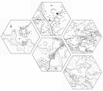
I've also included a map showing all five of the existing Baraloba hexmaps linked together.

baraloba-assembled.png
 

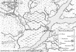
WEB-Quebec-Hexes-Patreon.png

Quebec City, 1666, with magic of course.

This is the setting for the Sugar Shack Slaughter, one of the two adventures in “The Scenario from Ontario“. Written by the remarkably Kiel Chenier, the adventure takes place in the area around Quebec City presented here.

Each hex in the map is 1/4 mile across – so if sticking to good terrain an adventuring party could travel 24 hexes in a day. Which just goes to show how big modern cities are – the location marked “Maple Ooze” on the map is actually within modern Quebec City (pretty much at the intersection of Boulevard Valcartier and Rue de la Riviere Nelson – there’s a convenience store there and I bet they have those gooey maple sugar cones that are ubiquitous candy throughout the region).

As a fantasy cartographer, it is always kind of intimidating to tackle a real world location in a map. You KNOW you aren’t going to get it perfect, and with real world locations people might actually notice what’s wrong as opposed to thinking that you did it that way on purpose. Mark Richardson (who draws the maps for the 7th Sea RPG as well as for the Government of Canada) aimed me at a database of topographical maps of Canada that really helped with this piece.

Over on the blog I’ve included a second version of the map with the sugar bush and maple ooze banners removed, although the ooze and its path are still visible (since I drew them on the map in ink as I was making it unlike the banners which were added in photoshop afterwards). Printed at letter or ledger size, the map looks great and will help in running the adventure in question, or can easily be repurposed for any other settlement along a major river.
 

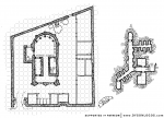
Keegans-Temple-Compound-grid-Patreon.png

Temples and churches are a fairly common sight in a city, but few maintain a standing military force without having a massive structure or complex to house them in. In the case of Keegan’s Temple, the finances were not available to build a massive church / temple / armoury complex. Instead a smaller temple was built in a walled compound donated to the church.

The compound has a main gate and a smaller postern gate for servants and deliveries. Wooden structures along the walls serve as stables, kitchens and barracks. The temple itself is often busy and also fairly exclusive to the order of lawful warrior-priests who reside and base there, so a smaller shrine has been built into the south wall for those who wish to give thanks to or petition the god of this temple without entering into the compound proper.

Beneath the temple itself is a small reliquary and crypt where fallen soldiers and aged priests have been interred and commemorated.
 

WEB-Blood-Maple-Patreon.png

As Canadian as Maple Syrup!

This is the setting for the Sugar Shack Slaughter, one of the two adventures in “The Scenario from Ontario“. Written by the remarkably Kiel Chenier, “dungeon” of the adventure is a massive hollow maple tree and tunnels among its roots.

Hollow trees are a favourite “dungeon” environment of mine, so I not only enjoyed working on these, but have a number of alternate uses planned for them for my own campaigns. The main level can work as an elven temple of some kind, with the central pool working as a scrying device or where the priests stand in order to be closer to avalon or the equivalent during their ceremonies. Or in a D&D5e campaign it can be the secret gathering places of the blights who are much more communal creatures than people think them to be…

These maps of the Blood Maple Hollow are redraws based on Kiel’s original maps. I made an effort to make it look as “tree-like” as I could manage for the level on the left, with the lower level on the right still having roots and tendrils to define the grid but being a bit more traditionally cave-like in textures as is my style.
 

View attachment WEB-Caverns-of-Quasqueton-Patreon-Numbered.png

The fortress/dungeon of Quasqueton was not completed before the residents marched off to war against the northern barbarians. While the main floors of the structure are almost finished, the in-progress nature of the structure becomes apparent when descending into the lower level which is still mostly natural caves that remain unworked for the most part.

Access to this level is either via the stairs into the finished structures roughly in the middle of the map, or via the hole that runs down from the smithy on the upper level, through a room on the main level, and down to the small cave with the pool of water roughly 100 feet south of the finished rooms.

I’ve also included this numbered version of the map that links up with the upper level maps. The removal of the pit trap from the main level of the original map meant that I moved the icy-cold pool of water (room 50) from underneath it to being underneath the shaft leading down from the smithy area – they probably used it to get cold water for the smithing process using a now long-missing bucket and rope.

The original cavern level included several caverns that were completely unkeyed – I’ve included roughly as many, but added optional lettered keys to these caverns to make stocking it easier. I’ve also purposefully skipped the letter I to avoid confusion with the number 1 – so the lettering goes from A to H on the upper two levels and from J to L on the lower level.
 

WEB-The-New-Circle-of-Doom.png

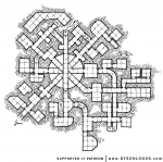
When I put the maps up for voting in May for the “Release the Kraken” project, I included an old favourite of mine, the Circle of Doom. But as I was getting it ready to post today, I gave it a good hard look and just didn’t feel comfortable releasing it. I drew the Circle of Doom in 2010 (maybe even late 2009) for a Labyrinth Lord campaign I was running at the time. I drew it in pencil.

Pencil doesn’t scan well. It comes out very light or very jaggy if I enhance the contrast enough to make it dark. Also, I’ve gotten a bit better at the craft since 2009.

So I redrew it.

I’ve USED it three times now in my games, but always stocking it “on the fly” using random stocking from the various rules we were playing with at the time. The dungeon “level” itself is centred around a massive shaft some 70 feet across spanned by four bridges on four different levels. I’ve run it as a rapid delve through four dungeon levels using level-appropriate encounters at each level (appropriate to the dungeon level, not the character level). In other words, it quickly goes from a team of halflings at the beginning to 8 hungry trolls guarding the exit.

So enjoy, and please – give your players the shaft!
 

WEB-Quiet-Margose-Tavern.png

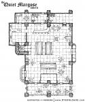
The sign hanging from the tavern shows a matronly woman carrying a large mug of ale while holding a finger to her lips in the near-universal symbol for being quiet. But the tavern itself is rarely quiet – it is one of the few places in town with a dedicated stage for musicians and entertainers and thus attracts a boisterous if friendly audience.

The Quiet Margose is primarily made of wood, supported by 16 heavy stone pillars. The main structure is flanked by a covered biergarten on one side, and a space dedicated to the owner’s quarters and a covered wagon entry where firewood is stored on the other. The stone pillars predate the Margose and were part of a prior structure here and still bear wards against evil from the older building. The walls are whitewashed wood, and the very high roof is made of heavy beams supporting pitch-black tiles.

The Quiet Margose is purely a tavern and offers no accommodations (although it isn’t uncommon to find or or two people “napping” at the long tables by the banked fire in the early hours of the morning). The owner, Tirril Lor, is the great-nephew of the titular Margose and books the entertainment himself – leaving the acquisition and preparation of food to the Qai twins who work the kitchen and live nearby.
 

WEB-Dosetlar-Cliffs-Patreon.png

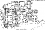
Tarnos Venn had a team of dwarves cut defensive structures into the Dosetlar Cliffs during the great war. The guard tower cut into the jutting edge of the cliff still looks nearly new, but the main entrance shows the damage of war and years - there are no longer any signs of where the great door once stood, instead there is just a rough and shattered-looking entryway into the stone face itself.

Tarnos of course had the dwarves build a secret exit to get out in case the front door was held or the complex was invaded and fell, but that exit has been lost. The exit leads to a few secret chambers (once home to Tarnos' fiancee and most trusted assassin), and then to the caves behind the fortress. Those caves are most often used by those in the fortress to store items that are of low value and high "stinkiness" - particularly pickled fish and such.

Semi-ironically, the most resent residents of the fortress has been considering building their own secret exit between the fortress and the caves, either right near the cave entrance or deeper into the back gallery, where it comes within 30-35 feet of the fortress structures.


Remove ads

Top