EN World City Project: Geography

Ok, now I'm done for the night. The other three gates don't need to be posted. Both Southgate and Eastgate are nondescript and Northgate can be seen on the Dwarven Quarter/District closeup.

Lalato: I vote Northwest to Southeast.

Conaill: haven't tried the random street feature as it is for designing random buildings along a street, not creating random roads (at least I don't think it does that).

Plus, it's not a pilon it's an island and no more river tributaries. That would be a MAJOR redo.
 

log in or register to remove this ad

I made some comments relevant to geography in a new thread I've started on history and religion. I'm interested in people's views on the history and any specifically geographical aspects of it (and for that matter, any historical aspect of your geography).
 

Knightfall1972 said:
Conaill: haven't tried the random street feature as it is for designing random buildings along a street, not creating random roads (at least I don't think it does that).
Yeah, that's what I meant: randomly placing buildings along the roads we have now. Not saying we need to do this for all of Mor's End, but it might come in handy as some point. Might even be useful to let people in the Craft and NPC threads pick out the exact building they want...

Pilon, island, same idea... Any particular reason for having a support in the middle? Seems like that might undo the "High" part of Highbridge. I.e. you'd get a dip in the middle instead a nice high arch.

No more tributaries... no problem. Guess it takes a little more work than just painting them in, eh? (Mind you, I'm just talking about something on the order of a big ditch here... no need to worry about bridges etc!)

No need to add any detail to Mage's Roost, by the way. The mage in question is reclusive and would *not* want any building crews on his island. The ruins on the island are way too ancient to still count as buildings. There's just one single tower in the middle of he ruins, where the mage lives.
 

Conaill said:
Yeah, that's what I meant: randomly placing buildings along the roads we have now. Not saying we need to do this for all of Mor's End, but it might come in handy as some point. Might even be useful to let people in the Craft and NPC threads pick out the exact building they want...

I agree but we need to make sure we're happy with the road layout first.

Pilon, island, same idea... Any particular reason for having a support in the middle? Seems like that might undo the "High" part of Highbridge. I.e. you'd get a dip in the middle instead a nice high arch.

Ahh, but it is a nice high arch for Pilon Island isn't at the same level as the shore or Citadel Island. The top of the island is roughly 50 feet above the river's water level.

No more tributaries... no problem. Guess it takes a little more work than just painting them in, eh? (Mind you, I'm just talking about something on the order of a big ditch here... no need to worry about bridges etc!)

A big ditch... Hmm, something to think about.

No need to add any detail to Mage's Roost, by the way. The mage in question is reclusive and would *not* want any building crews on his island. The ruins on the island are way too ancient to still count as buildings. There's just one single tower in the middle of he ruins, where the mage lives.

Done.
 
Last edited:

Knightfall1972 said:
Ahh, but it is a nice high arch for Pilon Island isn't at the same level as the shore or Citadel Island. The top of the island is roughly 50 feet above the river's water level.
I agree we can't span the river in one arc for Highbridge, but I don't quite see what you have in mind. Could you draw me a quick sketch of the side view? For comparison, here's my earlier sketch, reposted from two pages ago, using three arcs (the middle one is high enough to let all but the very tallest lake ships pass underneath):
 

Attachments

  • bridges.gif
    bridges.gif
    3.8 KB · Views: 186


CLOSEUP: Northern Docks

Ok, I've been adding docks to the Docks District. Here are the Northern Docks. The rule in CC2 when doing docks is to keep it simple, IMO.
 

Attachments

  • n-docks.jpg
    n-docks.jpg
    32 KB · Views: 178
Last edited:

CLOSEUP: Southern Docks

The Southern Docks. These and the Northern Docks are for those with less coin. Also the Southern Docks are imporant because of the Ferry crossing between the Docks District and Port Jollita.
 

Attachments

  • s-docks.jpg
    s-docks.jpg
    24.3 KB · Views: 172
Last edited:

CLOSEUP: Dock Harbor

Ok, this is the main dockyard for Mor's End. Note the water watch towers to help police and protect the dockyards. (I might put some towers on the shore too if you guys think that's appropriate.)

The docks attached to Dockwall are exclusively for the city's military and administrative sailing ships.

I'm thinking there will also be docks on the shore Port Jollita and the Merchant District as well... but not as extensive as these.
 

Attachments

  • dock-harbor.jpg
    dock-harbor.jpg
    27 KB · Views: 189
Last edited:

Pilon Island: That doesn't seem like a great place to put a bridge. A rock of that size would be more of a hindrance than a help in building the bridge. Ships would have to stay *well* away from it, so the highest point of the bridge would have to be in between Pilon Island and the Mainland (or Pilon Island and Citadel Island), giving us an esthetically unpleasing asymmetrical arch. Two high arches is possible, but then we'd get get a big height difference across Citadel Island to link up with Highbridge.

It might be clearer if you draw the bridge in place as well, including the arches (for ship passage) and road surface. Even better: do it "backwards": draw the bridge first, then figure out where the presence of such a rock in the river might be of help.

A secondary problem is that Pilon Island would also have gotten in the way in the pre-bridge era in the beginning of Mor's End's history. Such a rock in the middle would probably have made it a dangerous place to cross on horseback or swimming, not to mention driving wagons across a ford!


Docks: I highly doubt Mor's End would have that many piers sticking out into the river. Medieval river harbors mainly consisted of reinforced river banks where ships could pull up alongside. Piers are only necessary if you need to enlarge the amount of shoreline you have to dock ships at. Right now, the river bank in the main docks area (between the southern wall and Highbridge) is about 1200 feet long, which could easily fit 12 ships alongside it at any one time. Within that area, you've drawn about 30 piers sticking out into the river! That's one every 40 feet! You would barely have space for ships to fit in between...

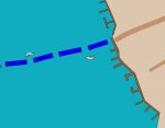
Have a look at these closeups of some of the maps I posted earlier (caution: LARGE!): Paris, Dockum, Maastricht, Zwolle. In each case, the majority of the ships is simply moored perpendicular to the river bank, with hardly any pier structures to support them. Only on the Paris map are there a few structures sticking out into the river, but that one is on a very different scale from Mor's End (anyone know what the population size of Paris was in the 1500's?) I assume ships would only dock parallel to the river bank when they're actually loading or unloading cargo. In that case, we should have *plenty* of dock space without needing to build any piers.

Just for the fun of it, we may want to have one or two piers anyway. They're cool structures, and an interesting locale for a DM to place a combat, for example. Such a pier could easily be 100-200 feet in length and 15-20' wide, not like the small walkways you drew.

Keep your scale in mind when you're detailing the harbor area. That little ship icon may be way off scale for a three-master. In my current RP group we did a little research to commision our own ocean-worthy ship. It wound up being 25'x75', which is only barely long enough for a three-master. River barges may be narrower but longer. I'd say count perhaps 30'x100' for your average large ship, including maneuvering space around it.
 

Remove ads

Top