Some hypothetical answers
Suppose you have an archipelago on and around the equator of a planet identical to Earth.
Suppose, for argument's sake, that said archipelago is pretty much identical to Indonesia/Malaysia/Singapore/PNG.
Now suppose the planet suddenly, somehow became 15 to 20 degrees colder.
What would happen to the climate of that archipelago, particularly with regard to rainfall?
Here is my answer to that question:
The current temperature of Earth is in the upper 50s fahrenheit, averaging out the whole planetary surface outside of Antarctica.
Dropping the temperature 18 degrees would put the temperature in the lower 40s fahrenheit, which would plunge your world into a severe ice age, if it were like Earth prior to the temperature plunge.
In the new regime, your archipelago would be much drier and windier than it once was.
During the northern hemispheric summer, chilly and incessant south-moving winds would blow relentlessly across your islands, and during the southern hemispheric summer cool north-moving winds would blast across the archipelago. These winds would slacken during the spring/autumn periods, but would otherwise be constant and unpleasant.
The Doldrums would consist of only weak tropical waves which generated occasional showers, not the deep powerful thunderstorms known on Earth today.
It is quite possible cold waves would reach the equator. Here, they would bring sharp chills, especially those coming from the Hemisphere in winter.
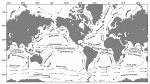
The water might well be cooler at the equator than on either side of it, clear around the world. The eastern Pacific suffers this effect now - during a severe Ice Age, the chill waters might encircle the globe. Your archipelago could bathe in water that was only in the 60s or even 50s.
So, the climate of your archipelago at the equator might look like this:
January: highs in the upper 60s, lows in the lower 50s, dry and windy
February: upper 60s, lower 50s, dry and windy
March: lower 70s, middle 50s, slight rain and windy
April: middle 70s, upper 50s, moderate rain and calm
May: middle 70s, upper 50s, moderate rain and calm
June: lower 70s, middle 50s, slight rain and windy
July: upper 60s, lower 50s, dry and windy
August: upper 60s, lower 50s, dry and windy
September: lower 70s, middle 50s, slight rain and windy
October: middle 70s, upper 50s, moderate rain
November: middle 70s, upper 50s, moderate rain
December: lower 70s, middle 50s, slight rain and windy
5 to 10 degrees away from the equator in the southern hemisphere (as Java is), the climate might look like this:
January: highs around 80, lows around 60, moderate rain and calm
February: around 80, around 60, moderate rain and calm
March: upper 70s, upper 50s, slight rain and windy
April: middle 70s, middle 50s, dry and windy
May: lower 70s, lower 50s, dry and windy
June: upper 60s, upper 40s, dry and very windy
July: middle 60s, middle 40s, dry and very windy
August: middle 60s, middle 40s, dry and very windy
September: upper 60s, upper 40s, dry and windy
October: lower 70s, lower 50s, dry and windy
November: mid 70s, mid 50s, dry and windy
December: upper 70s, upper 50s, slight rain and windy
(Note that during the dry season, temperatures fall 5.5 degrees per 1,000 feet of elevation, and during the wet season temperatures drop 3.3 degrees per 1,000 feet of elevation.
Thus, the dry season is also the cold season at high altitudes.
Freezing temperatures and snow occur above three or four thousand feet during the cold season, and above eight to ten thousand feet glaciers are found.)
Frost is unlikely at sea level, except perhaps when freak cold waves occur, reaching even the equator from the great icecaps during their winter seasons respectively.
The sun, of course, would still be as bright and strong as ever. One could sit out on the beach, and obtain a third-degree sunburn, while still shivering and shaking in the chilly winds blowing off the ocean (a situation that occurs today in coastal Peru.)
No hurricanes would ever blow, because the ocean would always be far too cool.
Convective activity over the ocean would be nil, and the incessant chill winds from one hemisphere or the other would supress convective activity over land as well (on this last point, I am guessing.)
No convection, no thunderstorms.
The only precipitation that would occur, would occur when the Doldrums moved across the archipelago, or were near the archipelago, and the cold ocean would weaken or perhaps eliminate altogether Doldrum-related rainfall.
If the Doldrums still produced some rainfall, sparce forests might grow, for cooler temperatures means decreased evaporation.
However, given little enough precipitation, you have prairie or steppe.
If the precipitation is shut off altogether, or at least seldomly occurs (or if all the precipitation occurs during only one or two months of the year) you have desert, archipelago-wide.
In the rain-shadow areas of mountains, it will be even drier, and perhaps no rain ever falls at all (as is the case in the Atacama Desert, which sits in the rain shadow of the Andes as well as bordering a cold ocean.)
- - -
Second question: What would need to happen to make desert regions on an equatorial archipelago possible? (And if I understand correctly, a desert requires nothing more than extremely low rainfall, right?)
Here are my answers to that question:
One way for a desert to exist at the equator is for the ocean at the equator to be cold. As is the case off of South America, and witness the Galapago Islands.
The cold ocean supresses tropical waves that might produce thunderstorms or even mere showers. Hurricanes die over the cold water. When the hot tropical sun tries to heat up the islands, the chill winds off the ocean prevent this warmth from causing convection over land (this last, is my hypothesis, at least.)
A second way for a desert to exist at the equator is for strong high pressure to dominate most of the year over the region.
If the Doldrums (the area where the northern hemispheric trade winds and the southern hemispheric trade winds meet each other) are far from the equator, it is likely that the Horse Latitude High of one hemisphere or the other is strong at the equator itself.
During the height of the northern hemispheric summer, and the height of the southern hemispheric summer, this is likely to be the case, as the summer pulls the Doldrums deep into that hemisphere and away from the equator.
During these periods, dry seasons - albeit short ones - exist at the equator.
But ...
What if the Doldrums were always far from the equator, stuck in one hemisphere?
Or what if the Doldrums marched really fast from one hemisphere to another, and did not linger around the equator for very long?
Then, you would have very long dry seasons at the equator, or perhaps it would be dry most of the time, and because of the equatorial sun evaporation would heat up the land ... with no rainfall, the land would dry out, which would allow it to heat further, which would dry it out further, which would heat it yet further, which would dry it out yet more, and you'd have a tropical desert.
Another way is for a strong monsoon to exist in one or both hemispheres.
In the Horn of Africa, in Somalia, the climate is that of a tropical desert, even though southern Somalia is at the equator and the Indian Ocean is quite warm.
The Asian Moonsoon generates winds and high pressure systems that interfere with tropical waves, and land convection under the hot equatorial sun. How it does this, exactly, I do not know ... but it does do this.
Perhaps, during the northern hemispheric summer, the winds roaring into Asia are so strong they produce a strong off-shore wind across all of eastern Africa. Such winds, blowing from the interior of the African continent, are dry winds. The Horse Latitude High of the southern hemisphere is stronger at the equator than it would normally be, further suppressing convection and tropical waves that might give east Africa rain.
Perhaps, during the northern hemispheric winter, the incessant winds roaring out of Asia produce a constant on-shore wind in eastern Africa. Coming off the warm Indian Ocean, this should produce rain, but the Horse Latitude High of the northern hemisphere is pushed far enough south to suppress all convection over the equator.
It seems to me that this is a case (see above) of where the doldrums are driven very far from the equator, during each respective hemispheric summer, and they do not hang around the equator for very long at all.
Obviously, if your archipelago has mountains, these mountains will produce rain shadows on their leeward side. Thus, you will have localized deserts on the leeward side of the mountains.
However, on the windward side of the mountains, you will have constant rainfall (unless the ocean is cold, as in the Galapago Islands.)

 .
.