Yes, exactly. If you do the work for us by either already doing the math (maps are currently at 28.24 pixels per square) or resizing them to 50 pixels per square, great! The workflow I use is only because, well, I don't know of a better way.
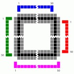
Measuring a single square is not accurate enough, just to be clear. If you have an image that starts off at 2200 pixels wide and you say it's 31 pixels per square, then the final map could be anywhere between 3498 and 3601 pixels wide. It makes a big difference. If the rescaled map is "close, but not quite there" then the tokens in MapTool will line up with the map wherever you match the image to the grid (say, in the middle) but will get progressively farther and farther off as you move away from the matched area.
Edit: Also, I realize that I may have confused you based on my workflow on the blog; sorry about that. That workflow is specifically for rescaling a map image I CREATED in MapTool. The only thing I'm using MapTool for there is for counting squares (because that's a drag to do manually).
For an image like the ZEITGEIST maps, I only use Paint.NET. Open the map, zoom way in, count the number of pixels from the first square to the last square, count the number of squares, do the math, rescale, done. At that point, I can import the map to MapTool and use it.


