• The VOIDRUNNER'S CODEX is coming! Explore new worlds, fight oppressive empires, fend off fearsome aliens, and wield deadly psionics with this comprehensive boxed set expansion for 5E and A5E!

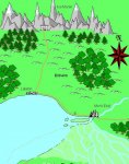
EN World City Project: Geography

Conaill

First Post
Looks pretty nice, TGD! How well does it do at drawing street plans?

PS: I still think the main trade route should go south of the river downstream of Mor's End. Otherwise there's not much reason for that important river crossing the city grew around...
 

log in or register to remove this ad

jdavis

First Post
TGD@work said:


That was the general idea but I don't have CC2 and haven't found any good free application (so far). I'll have a look at AutoRealm (if possible)

Also it seems my computer problems @home are there to stay. I need a backup for this ministership. If said problems persist too long that person might need to take over from me.
Any volunteers? (approval by Krug required)

Maybe somebody should post over in the art gallery forum to see if anybody over there can help. Maybe a assistant mapmaking minister.
 

Lalato

Adventurer
Conaill said:
Looks pretty nice, TGD! How well does it do at drawing street plans?

PS: I still think the main trade route should go south of the river downstream of Mor's End. Otherwise there's not much reason for that important river crossing the city grew around...

I think this could be explained if there is no way to go around the lake so that a river crossing is necessary somewhere along the Mor river. I suggest that the other end of the lake is basically blocked by the Kul Moren mountain range. Here is an image of what I mean (sorry... it was done in Paint)

--sam
 

Attachments

  • enheim.png
    enheim.png
    28.4 KB · Views: 144

Conaill

First Post
How about this instead...

It makes the swamp area larger, which I think makes more sense (the whole SE edge of the lake may be swampland, which provides for plenty of nasties which can form a threat to Mor's End and Kul Moren), it incorporates the ship trade (we did say Mor's End has a lot of ships passing through as well, right?), and it makes Mor's End an important river crossing on the North-to-East trade route.
 

Attachments

  • test003.jpg
    test003.jpg
    72.2 KB · Views: 149

TGD@work

First Post
Conaill said:
How about this instead...
It makes the swamp area larger, which I think makes more sense (the whole SE edge of the lake may be swampland, which provides for plenty of nasties which can form a threat to Mor's End and Kul Moren), it incorporates the ship trade (we did say Mor's End has a lot of ships passing through as well, right?), and it makes Mor's End an important river crossing on the North-to-East trade route.
You still need a road south along the lake for those who cannot afford the price of ship passage.
If everybody agrees, I'll add it to Conaill's drawing (Connali for Krug :D) and mark it as alpha version. I'll also extend the drawing to the west to accomodate for some of Lalato's requests.
 
Last edited:

Conaill

First Post
TGD@work said:

You still need a road south along the lake for those who cannot afford the price of ship passage.

Not really. Passage on a ship sailing across the lake should be fairly cheap. And if you *really* need to, you could always go around the northern end.

If there's that many nasties in the swamp and south of the lake, there will not be much of a trade route going through. There will probably be a small road/trail, but it would be highly dangerous and pass through the swamp.

Edit: let's see... Krug... Kurg? Nah, too subtle. Gurk sounds good, or maybe Urgk? :D
 
Last edited:

jdavis

First Post
perhaps a raised causway where the tall vegitation is kept cleared back away from the road. It would be a uncomfortable and dangerous trip through the swamp but cheaper than a boat (free is always cheaper than paying). Having boats also means that a village is going to sprout up on that side of the lake, where the barges would be loaded.
 

Buttercup

Princess of Florin
Yo! Grey Dwarf!

Knid Vermicious is asking some technical questions with regard to Highbridge that I can't answer. Cliff heights and so forth. Would you like to help him out? His thread is in the Art forum, and is called Fantasy Architecture.

Thanks!
 

Conaill

First Post
Already posted some more details on the bridges. Feel free to correct me if I strayed from the True and Righteous Path of Mor's End though...

Did we ever decide on a definitive scale for the map? We should be able to give Knid some numbers for the length of the bridge spans, the size of Citadel Island, etc.
 

Lalato

Adventurer
I agree with Grey Dwarf... a southern road is necessary. Here's why...

I have a caravan with a 100 pack animals, 50 carts, and 200 people. Which route would I take to Mor's End... The new boat route which will separate my cargo into several ships? I don't know those ship masters. What if they're untrustworthy. What if someone else tries to steal my stuff. My caravan isn't designed for this sort of travel. I could, instead, take the common route that has been in place for several hundred years. Sure it's a little dangerous, but that's why I have guards.

If I really want to avoid danger... I could take the old southern route that skirts between the mountains and deserts further south, but it would add nearly a week to my journey... and I'm not fond of the heat spoiling my goods. Besides, the river crossings further up the Mor river can prove disastrous to even the best caravan masters. This route through Enheim has truly been a godsend. :)

--sam
 

Remove ads

Top