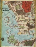
Faerûn is littered with many city-states, as well as proper kingdoms, states, and regions of governed and ungoverned populations that can be drawn with political boundaries.
But is this topic about the most detailed maps, or the amount of content written for a particular setting? Because I can tell you a lot about The Blade and Stars Inn, for example. It is located in Baldur's Gate, charges 3 cp for a pint of ale, and that it gets its name from the enchanted sign board looted from a ruined village in Amn after a trade-war. On cold nights, the proprietor, Aundegul Shawn, serves ruby cordial on request—a sweet, syrupy concoction of cherries dissolved in sugared red wine. (Volo's Guide to the Sword Coast, page 19).
Or, Hiexel trees are very common in the Dales, growing in thickets in ravines and on hillsides. They are rarer in the North, but can be found scattered there everywhere south of the Nether Mountains, particularly in the Rauvin and Delimbiyr vales. (Silver Marches, page 39)
Or, Midsummer and Shieldmeet are the most sacred days of the Oghmanyte calendar since they occasions when agreements are made or renewed and many contracts, bonds, and the like are drawn up. However, a priest of Oghma must observe two solemn rituals every day: the Binding and the Covenant. The Binding is a morning service wherein the symbols of Oghma are written in the dirt, in ashes upon a stone altar, or in the mind if a clergy member happens to be shackled or otherwise unable to write, while a silent prayer of loyalty and praise is made to Oghma. The Covenant is an evening service during which a passage from some work of wisdom is read aloud or recited from memory, a song or poem is offered up to Oghma, and some item of knowledge that the clergy member has learned during that day is spoken aloud to the god and to any fellow clergy present. (Faith's and Avatars, page 133).
But I suppose maps that lack political borders are stifling to the imagination. Hope this helps!
")

")


