• NOW LIVE! Into the Woods--new character species, eerie monsters, and haunting villains to populate the woodlands of your D&D games.

EN World City Project: Geography

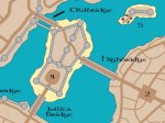
Me and my big mouth, well I am only moderatly less confused than before. I would prefer to see a North/South route comming to the city and then it splitting in the city to go either South East or South West. Mention was made of larger Kingdoms tot he North and I envisioned North to North East for those Kingdoms (on the Eastern side of the Mountains) I am assuming that the river flows to the east to a coast line somewhere and that coastlines are normally more civilized, so I was figuring the West for the Frontier. That would give a North/South traffic flow, make going southwest (towards the wild frontier) more dangerous and going southeast (back towards the coast) the Main road for North South Traffic, it forces a river crossing at Mor's End, going southeast bypasses the worst of the swamp and going southwest would be the road to the wild frontier and should be more dangerous. This would form a inverted Y with More's end at the center (and a road running to Kul Moren as a lesser route). Of course this is just what I was envisioning in my head. The X shape puts civilization on 3 of the four corners of the city and really takes away from the frontier feel, not to mention the town would be much much older and more important, it would be at the center of all the trade on this section of the continent. The inverted Y makes everything East of the lake and the mountains civilization and everything west of the mountains frontier and forces anybody moving west to go through Mor's End, thus it would be a newer city based on the expansion of the frontier westward. Maybe it's just my crazy American sense of direction kicking in but I just see the west as the wild frontier and the east as the old civilization.

I'll just wait for the official map as I am behind on this converation anyway and I think I covered what I was seeing, I was just confused to what went where.
 

log in or register to remove this ad

CLOSEUP: Docks & Squats (with scale)

Ok, here's another closeup. This one with a visible scale to get a better gudge of the city. If it's two big then let me know.
 

Attachments

  • scale.jpg
    scale.jpg
    63.3 KB · Views: 176
Last edited:

Off-Topic

Just wanted to say that those maps are very attractive, KnightFall. I have the version of CC that came with the 2nd Edition core rules CD. Is that what you are using, or is it the full version?
 

Mor's End: Version Five

Ok, the changes I've implemented to the city were brought about by an observation by someone who saw the first map on my personal CC2 thread.

He noted that the city was highly vulnurable to attack with the open waterways. Thus I've included walls with a single tower built into the center to protect these vital access points.

Of course, it's still possible to take ships through as on each side of the central tower, as arches are built into the river walls. Normally open, these arches can be protected by harbor chains and warding spells at a moments notice.

Westbridge has now be renamed Wallbridge. I've also added an internal curtain wall for the city which divides & protects the higher end region. The populace could retreat to either the citadel or the high quarter during an attack. Not that poeple in the lower district would have a chance to make it in before the nobility forced the military to close the gates.

Speaking of gates, there are now four new internal city gates, not including the three gates built into Wallbridge.

{EDIT}

Walls and towers didn't look right. Will post a reduxed version 5 in in a minute.
 
Last edited:

Re: Off-Topic

GladiusNP said:
Just wanted to say that those maps are very attractive, KnightFall. I have the version of CC that came with the 2nd Edition core rules CD. Is that what you are using, or is it the full version?

I dropped the coin for the full version, plus the city Designer 2 add-on. Still don't have the Dungeon Designer 2 add-on but that's only because of my current injury situation (on unpaid disability).

Of course, if the Mor's End crew wants to splurg for my birthday coming up then I could do buildings, dungeons and the citadel towers too. :D

KF72
 

Version 5 Reduxed!

Made the inner wall asn it's gates more clear. (At least to me anyway.) BTW, what would the city's gates be made from? Steel or reinforced wood?
 

Attachments

  • mors_end5.jpg
    mors_end5.jpg
    119.8 KB · Views: 163

CLOSEUP: High Market Area

This map gives you a closer look and the environs around the High Market. Note that the inner gates always stand open during the day, in order to allow for the flow of merchant caravans and the city's population from the High District to the other areas of Mor's End.
 

Attachments

  • highmarket.jpg
    highmarket.jpg
    57.5 KB · Views: 180

CLOSEUP: Jollita Square and Wallbridge

Here's another closeup - this one clearly shows that Wallbridge is just that, a bridge built out of walls and towers for defense. It is possible to sail under this bridge and past the eastern waterway wall, you just have to be important enough.

Merchant traffic doesn't usually go this way, having to go around the large island and out into Lake Enoria. *sigh* You know, I don't like Enoria for the lake name. It just looks to much like an inside joke.

How about Anoria instead? It's close enough that it sounds the same but different enough not to lend itself to the inside joke track.

Anyway, that's it for me tonight.

Cheers!

KF72
 

Attachments

  • jollita-square_wb.jpg
    jollita-square_wb.jpg
    86.2 KB · Views: 165

CLOSEUP: The Citadel (and Mage's Roost)

Ok, I lied. Here's my last closup for the night. :p
 

Attachments

  • the-citadel.jpg
    the-citadel.jpg
    93.7 KB · Views: 157

Whoah! Looks like you got a little triger happy with the walls there. :o

I don't think the danger from the rivers is nearly as great as you seem to think. If you check the medieval city maps that we've posted links to earlier in this thread, very few have such strong river reinforcements. Much more typical you get a tower on either side of the river, from which any passing ships are essentially sitting ducks.

The internal curtain wall is more problematic though. City walls are concentric - because they're built by the ones in power! You don't just give up the right or left side of the city when you're in trouble, you retreat to the center!
 

Into the Woods

Remove ads

Top