EN World City Project: Geography

If we're expecting enemies from the swamp, I don't think we want to have the swamp all the way up to the walls. Remember all those semi-aquatic races we were discussing? That's their homeground, and I don't think we want to let them sneak up to Tradegate through the network of little streams.

Obviously, vegetation will have to be cut back as far as possible, but I think we'd be better off with a stretch of firm open ground between the swamp and the wall. That way the defenders can send out sorties outside the walls without getting stuck in the mud.

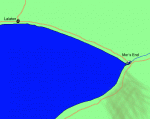
I think the hexmap on the previous page is reasonable in terms of how close the swamp is to the city walls.
 
Last edited:

log in or register to remove this ad

The hex map puts it at about 1200 feet. According to Conaill, it would take about a minute to traverse that distance at a full run. I'm OK with that.

That means it's close enough to be a serious threat if the watchtowers don't spot them. If the watchtowers spot them before they reach the edge of the swamp, there is just enough time to sound an alarm.

--sam
 

"I have created the worst map ever to show what I was thinking, the green is the swamp and the red is the trade routes, you can see that the route just goes through one corner of the swamp not across it."

Well, I can manage to do worse on the artistic aspects, but I will point out that this is a weird shape for our swamp. Normally it would be far more of a triange, with the large side facing the lake.
That would cause the trade route to go around it rather than thru, but it is a more realistic picture.
 

David Argall said:
Well, I can manage to do worse on the artistic aspects, but I will point out that this is a weird shape for our swamp. Normally it would be far more of a triange, with the large side facing the lake.
That would cause the trade route to go around it rather than thru, but it is a more realistic picture.

you have to remember the water is running out of the lake not into it. This is a giant lowland in between hilly forest, the water isn't really flowing in any direction in there it's just sitting. Of course it wasn't drawn with any real geographic logic involved, it's a giant plot device.
 

Of course it wasn't drawn with any real geographic logic involved, it's a giant plot device

truer words were ne'er spoke. :)

The lake is based on Lake Ontario in North America. The River is there because it was a compromise for Mor's End not being a seaport. The mountains are there because we want dwarves. The caravans are there to explain away the low population in the region and to give the place diversity. The swamps are there because swamps are... well... uhm... swamps are just cool and creepy darn it. :)

Actually... I never pictured them being swamps in the louisana bayou sense. I pictured them more as moors, fens, or marsh. As jdavis described it... it's a low lying area that is low enough to collect water from the lake, but too high to become completely flooded. The area is bounded by forested hills. It's certainly a geographical oddity, but there are enough geographical oddities in the real world that we shouldn't have to worry about explaining this one too deeply.

As for the lake... it is fed by streams from the mountains... and from an underground spring. I actually have an idea that the warrens underneath the city where the "the horror that lurks below" lives is a series of tunnels and caverns. One of those caverns opens into an underground pond that if you could hold your breath for an hour would lead you through the hole at the bottom of the lake... but that's something for my personal version of Mor's End... not for the "official" version. :)

--sam
 

Sorry I haven't been around you guys. I've been busy doing my own stuff and then holding off doing anything else, in order to keep the pain in my hand at a minimum.

You might want to check out my latest creation under my Aquatic Creature Fun thread (see sig) for a new gargoyle variant.

This might lead to another gargoyle variant which will be a swamp dweller, which would be perfect for the swamps around Mor's End.

I'll check in later this week and try to catch up.

Cheers!

KF72
 

I'm back...

I started trying to reconcile all the different scale maps we have, and I stumbled upon another huge discrepancy:

On the last hexmap TGD posted, the "Big Island" (still need a good name for that damn thing!) is about 1.5 miles long, slightly larger than Mor's End itself. However, on the latest large-scale map, the island is drawn about 13 miles long!

Personally, I think 1.5 miles is already pushing it, but at 13 miles, any fishing (or silk-fishing) industry based in or on the outskirts of Mor's End will pretty much only have access to the mouth of the river, not the lake itself.

I would suggest sticking with the earlier 1.5 miles for the island, and adjusting the lake shore so Mor's End is much closer to the lake itself.
 

Something like this...

Scale for this map is 10 pixels per mile. I've tried to draw Lalaton approximately 48 miles away, and the swamp 18 miles across
 

Attachments

  • mors_end_to_scale.gif
    mors_end_to_scale.gif
    22 KB · Views: 227

Conaill said:
I'm back...

I started trying to reconcile all the different scale maps we have, and I stumbled upon another huge discrepancy:

On the last hexmap TGD posted, the "Big Island" (still need a good name for that damn thing!) is about 1.5 miles long, slightly larger than Mor's End itself. However, on the latest large-scale map, the island is drawn about 13 miles long!

Personally, I think 1.5 miles is already pushing it, but at 13 miles, any fishing (or silk-fishing) industry based in or on the outskirts of Mor's End will pretty much only have access to the mouth of the river, not the lake itself.

I would suggest sticking with the earlier 1.5 miles for the island, and adjusting the lake shore so Mor's End is much closer to the lake itself.

Welcome back, Conaill!!!
I don't have a problem with the big island (Enoria's Tooth?) being smaller.

Personally, I would like to see a regional map that encompassed the entire lake not just the eastern half.

--sam
 

Lalato said:
Personally, I would like to see a regional map that encompassed the entire lake not just the eastern half.

Hm. For ease of portability, I would prefer restricting it to Lalaton in the West, Kul Moren in the North, the swamp in the south, and say 1/2 a day's ride (25 miles) in the East.

If we were building an entire world or region, obviously we would want to put Mor's End within the larger context. But since we're focusing on building a portable *city*, I think giving too much regional context is only going to hurt us...

Heck, some DM's may even wish to reverse the flow of the river, and make the lake an ocean instead. Right now, we don't really have anything that would stop them from doing so, which is just fine with me.
 
Last edited:

Remove ads

Top