• The VOIDRUNNER'S CODEX is coming! Explore new worlds, fight oppressive empires, fend off fearsome aliens, and wield deadly psionics with this comprehensive boxed set expansion for 5E and A5E!

Geography headache

The_Fan

First Post
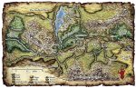
Obsessive type that I am, I've been trying to find a way to fit together the maps that have been released so far of the PoL world. Obviously, there's gonna be a lot of empty space. But what really bothers me is the Elsir River. It's the only common link between the two parts of Elsir Vale we've seen and it totally defies the rules of geography as we know them. In the first Scales of War adventure, the map shows it going off the map to the west. In the second adventure, it's going off the map to the east.

How is this possible?

The only explanation I can think of is if both are tributaries of a Greater Elsir, like the Blue Nile and White Nile.

Anyone else bothered by this? An suggestions?
 

log in or register to remove this ad

Sonny

Adventurer
If you take a look at the full map of Elsir valley from Red Hand of Doom, you'll see the new map connects right at the west edge of it.
 

Attachments

  • 95679.jpg
    95679.jpg
    172 KB · Views: 202

The_Fan

First Post
D'oh! Thanks. That solves all my problems right there. I need to find a larger version of that map though.

Edit:

...wait, no, that still has the same problem! The river goes nowhere! Or uphill! Gah!
 
Last edited:


mattdm

First Post
...wait, no, that still has the same problem! The river goes nowhere! Or uphill! Gah!

Yeah, the only way it makes sense is if the west and east forks are basically two separate rivers which together flow towards the little river whose name I can't read which then flows into Lake Rhestin.

It's a little weird for what then are logically really two different rivers to bear the same name, but weirder things happen in real geography.
 

Remove ads

Top