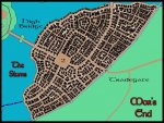
Knightfall's World of Kulan Campaign Maps (Updated: July 2022)

Knightfall

World of Kulan DM
NEW MAP: Around Ahalgot

Thia map shows the region surrounding The Icefoot Woods of Ahalgot. This map's main purpose is to flesh out the City-state of Reims, also known as The Radiant City of the North.

The icefoot halflings of the woods are great allies of the Kingdom of MaShir and the barbarians tribes of the Twilight Valley, to the east, beyond the Town of Fade Hill.

To the southwest are the Sword Lands (East), while to the southeast of The Radiant City are the decadent lands of The Ara-Ragik City Alliance and the County of Mistria.

To the north of Kingdom of MaShir and Ahalgot Woods are the Kaltar Mountains and the Sival Forest. These regions are home to many tribes of giants, barbarians, and verious types of humanoids.

Around Ahalgot.jpg
 
Last edited:

log in or register to remove this ad

Knightfall

World of Kulan DM
The Northern Continents of the West!
Okay, I've been busy updating the island chains north of the Lands of Harqual, which meant that my World of Kulan overview map needed to be updated. After finishing that, I decided that I needed a smaller overview of the region that shows the continents of Janardun and Harqual, as well as the surrounding island chains in more detail.

Thus, this map is the result.

And while the Isles of Valossa could be said to be large enough to merit being called "mini-continents" they are better described as "large islands".

The region noted on this map as The Frozen North is both connected to the history and mythology of Harqual and seperate from its denizens way of life. The Frozen North is home to both gods & men and is not to be treaded through lightly. Frozen death awaits anyone who travels here unprepared.

The same can be said for the islands known only as Ryaith. This cold, fey land is to Janardun what the Frozen North is to Harqual. However, the temperature extremes aren't as deadly throughout Ryaith, and the forested islands are both beautiful and untouched by humanoid greed.

The last set of islands visible on this map are the Wakuna Islands. They are opposite to the Frozen North and Ryaith in every way. The warm, southern currents of the Wakuna Sea make these islands tropical, while the Isles of Valossa are only subtropical in climate, due to the cooler currents of The Serpent Waters.

The southern shores of Harqual are considered subtropical, as a result, while the southern shores of Janardun are more temperate.

Cheers!

KF

p.s. This map is now out of date.

Around Harqual & Janardun.jpg
 
Last edited:

Knightfall

World of Kulan DM
City of Mor's End map nears Completion!

Okay, I've been working on my Mor's End map all day today. In fact, I've been slowly whitling down to its eventual completion, which is still likely a few months away. Those that put in the time with the EN World City Project will be happy when I'm done (as will I.)

Everything looks good now, although there are likely to be a few design inconsistencies.

Cheers!

Knightfall

Mor's End-November.jpg
 
Last edited:

Knightfall

World of Kulan DM
NEW MAP: Shantil Peninsula Region

SHANTIL PENINSULA REGION
This region is dominated by the Desinon Forest, which covers almost all of the Shantil Peninsula. At the heart of the forest is Lake Desinon, a fresh water lake that is fed from the surrounding mountains, which rarely freezes over due to the natural hot springs/vents that bubble up from the lakebed. (The lake freezes over only when the temperature drops below -30° Celcius.)

The cold of the north combined with the heat from the heated underground water makes the Desinon Forest a contradiction of foliage, animals, monstrous denizens, and intelligent races. Silver 'wild' elves and firbolgs are common throughout the forest, which feels almost subtropical during the summer months. The Free City of Windwall is the heart of civilization in the forest and is ruled by a matriarchal oligarchy made up of firbolgs.

Windwall -- also known as The Forest City -- has a long-standing alliance with The Shielded Northlands, which sits on the eastern coast of the peninsula. Fort Shield and Windwall agreed to this mutual protection alliance to deter the machinations of the ruler of The Blasted Reach (another name for the Blightlands). Karvo Melunsar (NG human male, cleric [North Gods] 6/fighter 6) has ruled Fort Shield since its founding over twenty years ago. He is a devout follower of the North Gods and has worked hard to build his new monarchy into a force for good in the Northlands.

Besides the alliance with Windwall, The Shield King has aligned itself with Fort Tundra and Fort Icemist (trade alliance). Fort Tundra is an even newer city-state in the north; it has only existed for the last ten years. It's ruler, Lady Morwen Devonald (N human female, fighter 4/sorcerer4) relies heavily on the local clans that have sworn fealty to her as well as aid from Fort Shield and Dragon's Eye Reach. The Tundra Princess would prefer to keep Karvo as an ally, only, but she may be forced to formalize the alliance by marrying The Shield King's foppish son, Markos. (He, at least, is a handsome man for his age.)

-----
Note: Hmm, I'm going to have to doublecheck which maps to repost. - KF72

Shantil Peninsula Region.jpg
 
Last edited:


Knightfall

World of Kulan DM
Meloncov said:
Nice details! Are you doing every building individually or did you make some sort of texture brush?

CC2 Pro a RPG Cad program, so, yes, each build was drawn out individually. Here's a close up of the City of Mor's End, which shows the Number Locales on the map.

Cheers!

KF72

Mor's End_Numbered Locales.jpg
 
Last edited:

Knightfall

World of Kulan DM
Here are some other closeups of the same city. - KF72
 

Attachments

  • Mor's End_Around The Downpour.jpg
    Mor's End_Around The Downpour.jpg
    113.2 KB · Views: 192
  • Mor's End_The Slums.jpg
    Mor's End_The Slums.jpg
    158.5 KB · Views: 203
  • Mor's End_The Green.jpg
    Mor's End_The Green.jpg
    217.8 KB · Views: 208
  • Mor's End_Dwarven District.jpg
    Mor's End_Dwarven District.jpg
    220.3 KB · Views: 207
  • Mor's End_Halfling District.jpg
    Mor's End_Halfling District.jpg
    179.2 KB · Views: 218

Knightfall

World of Kulan DM
Qualitian Belt

Okay, here is another repost. This one is mainly for Meloncov's reference, as I'm going to be making a request on his "landscape" thread.

The Independent Sovereignty of the Qualitian Belt refers to all the lands on the lands on the small peninsula that juts out into Lake Qualitian, as well as those lands east of the Thallin River, northeast towards Hamlet of Bredlend and Faliath's Tower (see below for more about this tower), and north to where Woodward Castle sits.

The Belt is ruled by a council made of six men and/or women, two members from each clan, plus one member of each major race in the region. (This is a council of ten individuals, as there aren’t members for “half-elves” or “other races”.)

The major attraction, on this map, is the tower located just north of the Hamlet of Breland, called Faliath's Tower. Faliath was a half-elven druid/sorcerer that lived in this region more than 300 years ago. He was known for for his quick temper and intolerance towards those that despoiled the wilderness. He often beset woodcutters with dire animals and conjured evil creatures. Then one day he simply vanished into his tower and was never seen again.

The citizens of the QUALITIAN BELT always stayed as far from the tower as possible, but as time passed people forgot about Faliath and his dispictable ways and now his tower is a crumbling ruin overgrown with moss. The local children often dared each other to run up to the tower and knock as ask if "Old Man" Faliath is home. So far, no one has answered. ;)

However, on the night of the 300th year anniversary of the druid/sorcerer's vanishing, a eerie fog rolled down from the tower across the eastern grain fields of the Belt. Since then the region has been plagued by insects and sightings of strange lights in the fields. The children are a little less bold now, even during the daytime. :p

Qualitian Belt.jpg
 
Last edited:

Knightfall

World of Kulan DM
Another map for Meloncov's reference. This one is a closeup of the Greystone Mountains based on the Greystone Mountain Region map (see this page).

Cheers!

KF

Greystones_closeup.jpg
 
Last edited:

Remove ads

Top