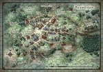
D&D 5E Starter Set: Phandalin Map

My point is, the Phandalin map is drawn in a precise top-down style (you can clearly tell the artist used a grid while drawing it). The benefit of using a style like that is to make it easy to judge exact distances. The lack of a grid works against that purpose. It just feels like they weren't thinking about why they were doing things--they just decided to make a town map because they felt like an adventure should have a town map.

Here. Don't say I never did anything for you.
hexdalin.jpg
 

log in or register to remove this ad


Thank you, Remathilis! That's a step in the right direction.

It still sounds like they don't know what kind of game they're selling. That map isn't a game map. It's a picture map. How could it support the DM using it behind the screen?
 

Thank you, Remathilis! That's a step in the right direction.

It still sounds like they don't know what kind of game they're selling. That map isn't a game map. It's a picture map. How could it support the DM using it behind the screen?

It's a village. Most of the marked locations are public, and the other few could most likely be found through a moment's polite enquiry.

It's meant to be used in front of the screen, not behind it.
 

Thank you, Remathilis! That's a step in the right direction.

It still sounds like they don't know what kind of game they're selling. That map isn't a game map. It's a picture map. How could it support the DM using it behind the screen?

I'll be using it next week.

Please don't tell my group that the map has no value.
 

For those who didn't catch it, in the Starter Set Unboxing video (time code: 29:30) Greg Bilsland mentions they originally didn't want a town map in the Starter Set, but the playtesters of the adventure deemed it necessary.

Greg Bilsland said:
Because people wanted a sense of what were the locations they could go to.

They compare it to having a map of the village of Homlet.

Thaumaturge.
 

Remove ads

Top