Discussion - LEW 4th Edition

Wik

First Post
Rystil Arden said:
I'm curious--what attracts you to the 'Caribbean model', per se? This is not an accusation, just an attempt to explore why. Myself, I'd rather just totally start from scratch, and if forced to pick from the real-world, I'd go with the Mediterrannean, heading out to the Arabian sea for sure, so I'd like to see what the advantages of the Caribbean are in your mind?

Well, truth be told, if this were a home game, I'd definately go with a mediterranean model - in fact, the current world I'm putting together is based off it!

However, for a PbP, where we want to encourage individual GM development, I think an archipelego setting, where the islands are fairly close to one another, allows GMs to add their own material easily.

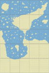
However, we also have a nearby continental area that would support a wide variety of land adventures - "central america" can support "trackless desert" adventures, and there are plenty of old ruins swallowed up by the jungles and swamps that we could throw in "South America". Really, if you look at the caribbean area (and by "caribbean", I should mention that I'm including much of the southern united states, and a good chunk of northern south america), almost every terrain type is included - about the only ones that are missing are arctic regions and deciduous and coniferous forests, and we could have those lining the coasts of the "north american" continental landmass.

Plus, the caribbean model supports a very popular method of gameplay in D&D - pirates! As a lot of best-selling D&D supplements can show you, pirates sell. And a caribbean/island scenario is the best way to support pirate adventures (without necessarily forcing it down people's throats)

***

For the record, I believe a "South Pacific" model could work fairly well as a map model, and the mediterranean model (if centred around the Aegean sea) could work, too. The only reason I think the Caribbean works best as a model is that it's not as familiar to D&D Players as the mediterranean - I know that there are a lot of maps that are based off the mediterranean.

A caribbean model is easy to fiddle with so that it doesn't look like it's base - simply flip it so that the islands are west of central america instead of east, and mess with placement of the larger island masses. And maybe throw an island where the gulf of mexico is.

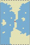
And Goblin's idea of flipping the island mass so that north america is in the south and vice versa is also a great idea.
 

log in or register to remove this ad

The Goblin King

First Post
can't sleep. clown will eat me.

so as to better illustrate what I was thinking about I blocked in some land.

first is the world render. the finished version will be much more accurate instead of just drawn freehand. not show is the northern and southern icecap. the southern landmass just kind of flows into where antarctica would be. the red square is the area of interest.

next is the regional veiw. this area is 3,125 miles by 4,275 miles. each of the 25 regions show an area 625 miles by 875 miles. I merely wanted to show the land countours. finished map will have terrain.

last is the local view. map number 13 was where I put the starting city if you guys wanted to do that. its smack dab in the middle of the map. each hex is 25 miles across. again, I didn't put any terrain just wanted to show land.
 

Attachments

  • world1 render.png
    world1 render.png
    40.1 KB · Views: 84
  • region 1 render.png
    region 1 render.png
    158.6 KB · Views: 102
  • map 13 re-render.jpg
    map 13 re-render.jpg
    132.4 KB · Views: 101

Wik

First Post
What program did you use to get that? Because the hex mapping is pretty nifty!

I like the middle map, although I would localize the islands into chains a bit more. But the general idea is something I could totally get behind - Make that bottom landmass a desert, and the top landmass could be jungle. The island in the upper left would be forested... and we could have a pretty good, usable map, right there.
 

Someone

Adventurer
I must add that, looking at the EnWorld example, newly defined lands come in two varieties:

-DM defined; these are the locations described in the modules played. Since most adentures start in the RDI, and still nobody can Teleport or Wind Walk, this naturally mean that most adventures are located near Orussus. The result is that we have a central location quite well descibed, mainly because in an adventure the DM must describe the environmen well if he wants the players knowing what's going on - this means details about distances, architecture, inhabitants, and who lives where.

-Player defined: Details included in backgrounds. These tend to be vague and mold into existing stuff or, more important, descibe far away lands from where they come.

I think we should pay attention to this pattern and don't try to describe or map the whole world, just the "central" portion where the starting adventures will be set, since experience demonstrates this is the nfrmation DMs need most, and leave far away lands less defined so DMs and players have freedom to invent their own lands and backgrounds.
 

Bront

The man with the probe
Someone said:
I must add that, looking at the EnWorld example, newly defined lands come in two varieties:

-DM defined; these are the locations described in the modules played. Since most adentures start in the RDI, and still nobody can Teleport or Wind Walk, this naturally mean that most adventures are located near Orussus. The result is that we have a central location quite well descibed, mainly because in an adventure the DM must describe the environmen well if he wants the players knowing what's going on - this means details about distances, architecture, inhabitants, and who lives where.

-Player defined: Details included in backgrounds. These tend to be vague and mold into existing stuff or, more important, descibe far away lands from where they come.

I think we should pay attention to this pattern and don't try to describe or map the whole world, just the "central" portion where the starting adventures will be set, since experience demonstrates this is the nfrmation DMs need most, and leave far away lands less defined so DMs and players have freedom to invent their own lands and backgrounds.
I agree.

Having a "general" idea of the shape of the world, or even a small "landmass" map is probably not a bad idea. But letting DMs and Players shape the world first is a good idea, and I think will solve not only the "First come first serve" issue (which yes, will be present for players of characters and DMs who are first, but at that point, you've started), but you allow for a lot of freedom in the inital creation of the world.

If I remember right, LEW didn't have a map at all beyond the rough pencil scetch for years.


The Goblin King

First Post
Wik said:
What program did you use to get that? Because the hex mapping is pretty nifty!

I like the middle map, although I would localize the islands into chains a bit more. But the general idea is something I could totally get behind - Make that bottom landmass a desert, and the top landmass could be jungle. The island in the upper left would be forested... and we could have a pretty good, usable map, right there.

First I made the 25 regions in AKS Hexmapper then I pasted each of the maps into Inkscape and scaled it down. The world map was also made in Inkscape where I just scaled the continental map down and redrew the outlines with the freehand tool.

Also, remember that 25 miles is a lot. The map will never be able to show more then the basic information.
 

Wik

First Post
Alright. That program is incredibly cool. I've been playing with it for a few days. Absolutely love it.

Y'know, I think everyone's right about the map - we can argue about it later. What about Meta factors, though? That's a topic that I think I sort of bulldozed over. Do we really have a consensus over things?
 

Patlin

Explorer
stonegod said:
Non-Sharn Adventures
- Zombie Hunt (our third adventure)
- Heart of Artifice
- A Simple Job
- Beer Run
- What Happened?
- The Eidolon (eventually I think)
6/16 adventures.

Traps and Wards wasn't in Sharn, though as it essentially took place entirely around or within a single manor house, so it didn't offer much in the way of exploration.
 

Wik

First Post
So, I was walking to Staples today, and I was thinking about L4W. Namely, how and when do we go about picking up judges?

a few questions about the process:

1) When will judges be set up? (I suspect january or so, right?)
2) How many judges will there be? (Five?)

Now, I was thinking it'd be neat for the judges who want to be in on the world-building/living campaign set-up to have an "Election". After all, I think it'd be a position a few people would want (who wouldn't want to have a seat on making up an entirely new living world?). Basically, we'd have an 'elect a judge' thread going on in both LEW and LEB. Anyone who wanted the position would step forward, and say "Hey, this is what I would do if I was on the world-building committee".

Things like "This is how I feel about D&D religion, this is how I think the main city should be, etc...". Everyone that currently has a character in a living game gets a vote. WE tally up the votes, and those people start work on meta issues, and, when we get rules updates, the actual building of the world.

Once the game starts, they act as judges for three months or so, and then we figure out who will be "actual" judges. Or something like that.

That initial building group would be responsible for deciding upon the shape and manner of L4W.

***

In other news, I'm actually a little less excitied about L4W, and more about LEW in general. Don't ask me why, but I've recently come to dread 4e for some reason. I think it was adding Eladrins and Tieflings that did it for me.
 

Remove ads

Top