The EN World FREE Map Request Thread!

jaerdaph

#UkraineStrong
Thanks guys! :)

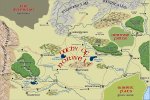
I really don't like the way fonts look when they come out of CC3 in BMP/PNG exports. This was a problem in CC2 as well, but even with the new sheet effects, they still seem a little funky.

Hopefully I can spend some more time on this tonight when (if) I get out of work tonight.
 

log in or register to remove this ad

jaerdaph

#UkraineStrong
More progress tonight since the Yankees have teh suck once again and I'm disgusted. I've played around with exporting images at higher resolutions in CC3, so this image is a little larger but the fonts look sharper. When I post the final image, I'll go back and delete all these work in progress images to save on resources unless I hear otherwise that it isn't a problem to leave them on the EN World server. I'm really enjoying this project because I've learned a few new things about CC3 and have been able to try some new tricks I've seen from others over the years.

Bastion, if you notice anything weird - most notable any spelling errors on the map text labels - feel free to let me know. They are easy to correct. :)

EDIT: It helps if you attach the image...

Edit: Removed WIP image
 
Last edited:

The map looks great. I printed it at work 11x17" B&W, it looked awesome and we used at my game last week.

There are a small # of miss-spellings(since you asked).
-To the south west, a small village named Black Bridge (not Ridge)
-To the south east, a small creek named Haplin's creek (not Haflins)
-And near the center-west, in some hills there's a pass called Hob pass, (not Hos)

Thats all I noticed. I do have one humble request though, and feel free to ignore it if its to much work...

When I print the map in B&W, which until I figure out how to get a color version printed @11x17" is how I do it, the trails are undistinguishable from the rivers. I know you said earlier that you didn't like how the dotted line looked, but in B&W, that might be better.
If this causes you to have to retrace all the trails then don't do it. I just thought maybe you could toggle or change just that layer or something.

I just want to make sure you know how much I appreciate you spending your free time helping me out. And since I may be looking for more maps in the future(especially the Duchy directly south of this one and the continent map), is it ok to contact you via email regaring some arraingments($$)?

Let me know.

Thanks
Bastion
 

jaerdaph

#UkraineStrong
BastionLightbringer said:
The map looks great. I printed it at work 11x17" B&W, it looked awesome and we used at my game last week.

Excellent - I'm thrilled it is seeing use! :)

There are a small # of miss-spellings(since you asked).
-To the south west, a small village named Black Bridge (not Ridge)
-To the south east, a small creek named Haplin's creek (not Haflins)
-And near the center-west, in some hills there's a pass called Hob pass, (not Hos)

Not a problem, easy to fix.

Thats all I noticed. I do have one humble request though, and feel free to ignore it if its to much work...

When I print the map in B&W, which until I figure out how to get a color version printed @11x17" is how I do it, the trails are undistinguishable from the rivers. I know you said earlier that you didn't like how the dotted line looked, but in B&W, that might be better.
If this causes you to have to retrace all the trails then don't do it. I just thought maybe you could toggle or change just that layer or something.

That shouldn't be too much of a problem. I should just be able to toggle the line width and line style (to dashed) on the existing trails and maybe nudge a few symbols around.

I just want to make sure you know how much I appreciate you spending your free time helping me out. And since I may be looking for more maps in the future(especially the Duchy directly south of this one and the continent map), is it ok to contact you via email regaring some arraingments($$)?

That's a generous offer but I'd feel funny taking your money because this is the EN World FREE Map Request thread after all. :) My other concern is that I work 10+ hours a day at a prominent Wall Street law firm, and in the fall I will be going to law school at night (which scares the crap out of me since I haven't been in school since I got my master's in the late 80s). I'd hate to promise you something and not be able to deliver. Also, CC3 has transcended from "RPG hobby playing tool aid" to "hobby unto itself" for me, and I find it very relaxing using the program, so this is how I would be spending my free time anyway, so it's nice to have something to use it for. So let's just play it by ear for now. If you do feel so inclined, please consider giving a few extra bucks to your favorite charity instead. :)
 

Shadeydm

First Post
I could really use a player handout map (free of encounter keys etc) for both the city of Pedestal and the Great Grotto if anyone has access to the The Sinister Spire (WotC adventure) and feels up to the task.
 

jaerdaph

#UkraineStrong
Shadeydm said:
I could really use a player handout map (free of encounter keys etc) for both the city of Pedestal and the Great Grotto if anyone has access to the The Sinister Spire (WotC adventure) and feels up to the task.

I don't have that adventure, but I do want to try my hand at a city map eventually. I'm anxiously waiting on the City Designer 3 add on for CC3 to come out! :)
 

jaerdaph

#UkraineStrong
Well, I think this is almost done. :)

One question: there is a road in the southeast corner of the map between Black Bend and Chazick that ends abruptly. Should that continue on to Chazick?

I'm really quite pleased at how this turned out. :cool:

EDIT: One more question: Is it the High Hink or High Link Trail between Aegress and Abbingford?

Edit: Removed WIP image.
 
Last edited:

Great job. I really like the Fenlon style.

The trail is actually High Hawk Trail. Also, just south of it I just noticed Gornlee pass spelled wrong(if not too much trouble.)

Also, can you label the trail east of the Dasineen river going towards Strockberg as the East River Trail?

And yes the trail you mentioned should lead to Chazick.

Thanks again. Hopefully I can get another map posted for ya to practice on. ;)
 

jaerdaph

#UkraineStrong
Easy fixes - here you go. :)

I'm going to go back now and delete some of the earlier WIP (work in progress images) from my older posts now to help save on resources.
 

Attachments

  • norwellfenlon08.JPG
    norwellfenlon08.JPG
    2.1 MB · Views: 201

Hussar

Legend
I'm going to be running a Savage Tide campaign very shortly. Two things that I could really use are battlemap scale maps of city streets and jungle beaches.
 

Remove ads

Top