(Casual D&D) A Game of Trust

Well

(rolled 9+2ranks+4int=15)
(I also have craft cartography, but will wait for what i know before i suggest attempting to make a map.)
 

log in or register to remove this ad

OoC:Sorry all, I took a rather nasty slip/fall and whacked my head Friday night at work, and I haven't been online since, as a result.

IC: Niccolo begins working on his Banner, regardless of the caution of some of the folks around him, they'll see, TRhe White DOve' will be a fine Troupe of Heroes.
 

[Fendric does not have Knowledge (Geography).]

From his notes, Fendric reads the names, titles and locations of the letters.

"I'm afraid clerical study doesn't afford me much of a chance to know the lay of the land," Fendric continues, "shall we start with Eivanrach, since that seems to be the direction we've headed?"

"Oh. One more thing. Aerda suggested that we each carry some letters, and I concur. If you'd like to ride up, I'll hand each of you some."

[Fendric will hand Aerda the first two letters on the list, Niccolo the next two, and two to Merrim. The last two he'll keep in the saddlebag, because he doesn't want to burden the fighter with letter delivery.]

"Pelor bless this noble journey. Let's ride!"
 

Aerda: The city of Bethel is surrounded by many smaller cities, including the four major satellites, of which Jance would appear to be most directly en route. The Kingdom of Bethel itself is protected to the West by the Ashen Mountains, which stretch from far to the south until they meet with the Sea of Morel. On the South side, the Kingdom of Bethel is relatively unprotected, leading to some dispute over territory with the Kingdom of Dalmar -- in truth, what lies between is relatively ungoverned, although the towns and cities in this middle-region pay a sort of unspoken heed to Hedrogura, which is an important post of trade, both seafaring and otherwise.

Beyond the Ashen Mountains, there is a relatively large region of semi-isolated city-states, pocketed between two large mountain ranges. Despia and Eivanrach are the only ones you're particularly familiar with: They're the largest, near the Western and Eastern edges respectively. There is a pass through the mountains somewhere on the border of Bethel, but you are not sure where, exactly.

You don't know much, geographically, about The Kingdom of Tourne, except that it is much larger than either Bethel or the area occupied by the Free Cities -- and, as mentioned, that it lies beyond the Sea of Morel.

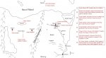
(There are a few more details -- other city names you know, and the like -- that I'll put on the map once you make the Craft (cartography) check -- as they probably won't be useful to you before then, anyway. What you know, and where things are in loose relation to each other, is dependent on that knowledge check -- the craft check will just be to determine how accurately you can convert what you remember about the roads taken, the distances between places, et cetera, into a spatially coherent map.

Also, once you all begin riding, make Spot checks.)
 
Last edited:

weee!

"I'm fairly confident i could fashion a map, especially as i've taken many of these roads myself. It may take some time, but it would be worth it, don't you agree?" He bids astrule into the air, to search the terrain in large circles, making sure that if everyone waits, his work would be largely un-interrupted.

(Craft-Cartography=15roll+4ranks+4intelligence+2 for MW tools
thats 25 :cool: )
 

After some time working, Aerda produces a rather nice-looking map. (Far nicer-looking than the one I whipped up :) )

(BTW, make those Spot checks now)
 

Attachments

  • aerda-map.gif
    aerda-map.gif
    23 KB · Views: 140

whistling to herself, Merrim nets a 2 on the spot check. "Wow, would you look at how many sizes the blades of grass come in. Fascinating. Did someone say something?"
 

On the wings of a bird.

(Ok, am i thinking right, or wouldnt the hawk's spot be +14? +6 listed under skills and +8 for racial bonus since it is day? or would the 8 just overlap the 6, that doesnt seem right. Hawk: 9+14[8]=23(17) Aerda: 13+1wis+2racial=16

The attatched map is the version he ends up with, after correlating the addresses and the locations on the map. I'm looking forward to the sea voyage, i'm a big sailing fan.)

Aerda rides quietly, dividing his attention between watching the terrain and interpreting astrule's emotions as they are fed to him. He sometimes envied the hawk's ease in life, now diving for food, or simply enjoying the warm draft he rides on. Flight is the hawk's most envied feature, and Aerda wished he could see out of the hawk's eyes. He smiles, but his elven ears and eyes are ever alert.
 

Attachments

  • map.jpg
    map.jpg
    94.5 KB · Views: 130

[Spot check: 19.]

As Fendric rides, Niccolo seated behind him, he scans the terrain for any sign of the road they were traveling.

Noticing Aerda's excellent map, he exclaims, "Pelor bless us! Now we shall know where we're going!"
 

"Wow," exclaims Merrim, "that map is really nice. I didn't realize there were so many places in the world to visit. I haven't been to hardly any of them. Perhaps on this journey we'll get to go to some of these places."
 

Remove ads

Top