I was more asking whether you will continue to publish the maps separately online as jpgs (or other image formats), or whether the maps for Zeitgeist will only be available in the adventure pdfs.
I ask because I can't see anywhere in the old subscriber or new subscriber areas that the WotBS maps were separately published in image format.
If a Zeitgeist map is separately published as a jpg or image file (as you have done here), I can download that image directly into virtual table tops and use it as a battlemat.
If the map is not separately published, but exists only as part of the adventure pdf (eg at the bottom of pg 56), then:
- there may be some loss of quality during the process of putting the map into the pdf;
- the map might be skewed somehow to get it into the pdf (such as by narrowing its width but not adjusting its height); and
- virtual tabletop users such as myself and OnlineDM need to extract the map out of the pdf into our tabeltop program of choice and then hope that the squares on the map are actually square, which leads into:
To clarify, the pixel to square ratio of a map is a measure of how many pixels wide each square on the map is. Think of it as zoom level. A '20px per square' map is a zoomed out map, because each square is tiny. A '100px per square' map is a zoomed in map, because each square is huge.
Most virtual tabletop programs include a 'grid' that governs movement and range. The grid, rather than the squares on the image file, is used to count PC and monster movement, range etc. Therefore, to get the maps to work with the virtual tabletop, gamers need to ensure that the pixel to square ratio on the image file matches the pixel to square ratio on the virtual tabletop grid. If it isn't, then PCs and monsters will eventually end up outside map squares.
For example, when I tried to create the githzerai monastery map from WotC's Den of the Destroyer (or indeed the keep from Keep on the Shadowfell*), I found it impossible to get the grid to line up with the squares. I concluded that the map had been squeezed at some stage so that the squares on the map weren't in fact square, thus they couldn't align with the grid (which
is square).
In my ideal world, the Zeitgeist maps would be published separately as image files, with either an indication of their pixel to square ratio (ie. how many pixels long is each side of the map squares) or with every map having the same ratio. Ideally it'd be a nice even number like 30 or 50 or 100, but the actual number doesn't matter so long as we know what it is. 51.6 pixels per square is fine so long as we know it's 51.6, because that allows us to alter the virtual tabletop 'grid' to match the squares on the map without having to eyeball it.
This information should be readily available to the person who created the map because I believe it's something they set during the creation process, and it could be made a part of the work order for maps that haven't been ordered or finalised yet (ie "map of X. Each square on the map should be 50 pixels by 50 pixels".)
Now all of this is obviously above and beyond anything any other publisher that I know of does, but I ask anyway because it would be really cool if you could accomodate us.
*Yes, OnlineDM, you ultimately pointed me to the Mad Mapper version.

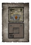
 will look like? Here's a quick preview of five of them.
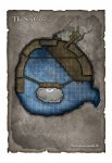
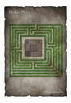
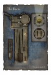

")


