D&D 5E (2024) Atlas of Faerun (with some pictures from the internet)

I wouldn't be at all surprised if this isn't just an expanded / updated version of the SCAG map. I'm pretty sure Mike said back in the day that the full map he'd made was bigger than what got printed in the SCAG.
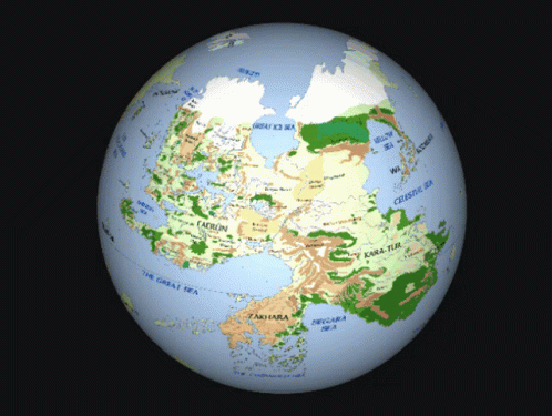
Yeah. If I was in Schley's position, I'd probably map out the entire thing (at least linework) in order to maintain consistent scale, and pull out the area needed for a given book. It'd be more work upfront, but solid futureproofing.
 

log in or register to remove this ad

If you look at the pictures and compare it to his SCAG map, it's clearly the same artist, but not the same map but extended. He does the water differently, colour's pallet is a bit different, ect...View attachment 413943
Schley's work for 5e has tended to have more colour gradience, while his work for 4e was more flat. The maps in your OP look much more in line with the 4e maps, so I wonder if they're older unused work.
 

Not only is there going to be a poster map in the forthcoming FR book set, but Beyond will have some sort of interactive Atlas.
Oh, are WotC finally catching up to fanmade works like this? Would be nice if it was an interactive globe.

tenor.gif
 

Looked at a map, if they include all of Sempur in the map and they go right past the most southernly spot on the Shining Coast, they will have to include the North Western corner of Zakhara, including the Corsair Islands and some coastal cities. This is because the southern most latitude of Faerun is to the south of Zakhara's most northern latitude, and Zakhara's northern coast actually is diagonal with part of the Shining Sea coast.
They could put the key over it, or a compass rose.
 

Good observations. I can't imagine he started from scratch, though. He'll have many layers on his working file, one of which is probably an outline of the land masses and islands.
I had a spare moment, so I decided to test this. Using GIMP, I scaled up the maps of north Sword Coast (from Lost Mines of Phandalin) and south Sword Coast (from Scourge of the Sword Coast) and overlaid them on the Sword Coast map from SCAG, and there was enough deviation in form that I'm confident in saying Schley did them separately from scratch, which seems incredibly inefficient to me.
(I bet that working file is ginormous!)
Yes. There was an interview I watched last year where he mentioned he had multiple photoshop files which were like 20GBs each.
 
Last edited:

Yeah, ‘Hordelands’ is pretty easily interpreted as a term used for the steppe by outsiders. Presumably the Tuigan and other nomads have their own name for it, although it’s probably been 35 years since I read those novels so I don’t remember what that might be.

(Damn they did Yamun Khahan dirty in the last book though. Such a weak ending!)
Following Yamun's death, his son Hubadai established Yaïmmunahar in the "Hordelands", as described in Dragon #349. If it's still around, the nation would be almost 140 years old now.
 

Maybe, or maybe it's just reflective of the fact that the Dales have been exhaustively covered in lore and other setting products (the 3e FRCS for example) in the past, so are more filled out than further-flung lands.

Very happy to see the Shaar back, it was a travesty what happened to that place in 4th edition. I wonder how far the map will stretch? Kara-Tur? Maztica? Zakhara? Osse?
We might get a small outline map inset of the other parts of the setting, like in the 3e FRCS, but I doubt this detailed map will go further than Faerûn proper. The real question is whether it will stop shy of the south coast like the 1e and 2e maps, or cover that area as well like in the 3e FRCS map. The third picture gets close to the area where that question would be answered, but stops just shy of proving it one way or the other. It does appear that they've reverted back to the 1e/2e geography, though, and not the 3e version which was a bit squished and re-arranged in parts to get it all on one poster map.
 

Interesting that the map becomes significantly denser with locations around the Dalelands, I wonder if this combines the poster map with the more focused regional maps we will likely see in the Adventjres Guide?

That's just previous coverage supplying names. Cormyr is actually much denser in locations than the Dalelands, so much so that the kingdom's name is almost over the border to Sembia. And Turmish is very dense as well, even though it's nowhere near any of the five featured regions.
 

Remove ads

Top