D&D 5E (2024) Atlas of Faerun (with some pictures from the internet)

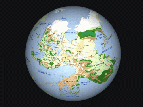
It depends on how far south and east they go. If they go as far as Ed's original maps - southernmost latitude being at Nimbral and the very southernmost coast of Faerûn between Halruaa and Dambrath, easternmost longitude at the Howling Gap and the eastern limits of Ulgarth, it will just miss Zakhara at the southeast corner. If they go much further, then, yes, it will clip parts of that continent. But even then, it's not going to show much of significance (the area in question is unsettled barren coastline) unless they greatly expand the map's reach beyond Faerûn proper. Once a hypothetical map gets fairly significantly south of Nimbral, then places like the Pearl Bay and the Corsair Domains would start showing up. I personally don't think they'll go much beyond the original Ed maps, if they even go that far (hence my wanting to know if the south coast is on the map).

I think that would still clip at least some of the Corsair Islands, but I could be wrong.

I mean I'm fine with having some Zakhara on the map, reminds folks that Faerun is the beginning not the end.
 

log in or register to remove this ad

Oh, are WotC finally catching up to fanmade works like this? Would be nice if it was an interactive globe.

tenor.gif

I loved that, but this map is only Faerun (well mostly) and goes into much greater detail then even the Faerun on thus globe.


This is definitely Mike Schley's work.
Unfortunately, none of the maps that have upside down black triangles have a key, and the ones that have a key don't contain that symbol, so it's hard to know for sure. However, the map of Vaasa uses that symbol for Delhalls, Talagba (both Dwarven mines) and Hillsafar Halls (a Dwarfhold), but also Sorath-Nu-Sum (a former Kua-toa city in the underdark), so it seems likely that it's used for underground settlements. On the other hand, it's not used for the likes of Mithral Hall on the SCAG map.
Upwards black triangle tends to be used for temples.
White triangle is used for mountain peaks, specifically.
Black circle is cities, while white circle is towns, and black star for capital cities.
Slightly frustratingly, Schley is not fully consistent in his use of symbols, where a black X is sometimes used for ruins, and other times for points of interest. In the latter case, either a black square or black rhombus is used for ruins. In the case of the first map, X is used for points of interest (The Dancing Place and The Five Lions) while a black square is used for ruins (Gildenglade was destroyed), as you note.

I love that we have the key figured out without access to it, just based on place names and in your case previous maps.


Maybe, or maybe it's just reflective of the fact that the Dales have been exhaustively covered in lore and other setting products (the 3e FRCS for example) in the past, so are more filled out than further-flung lands.

Very happy to see the Shaar back, it was a travesty what happened to that place in 4th edition. I wonder how far the map will stretch? Kara-Tur? Maztica? Zakhara? Osse?
I recall hearing that icewind dale was it's northwestern terminus and Thay is its easternmost nation. I think that would put Luiren at its southeast corner.


Remove ads

Top