I draw the occasional D&D map


log in or register to remove this ad


WEB-Drow-Spire-Revised.png

In grand underdark caverns the dark elves build their cities. The oldest families establish themselves in the more defensible positions and as close to the centre of the cavern for defensive advantage against invaders.

Today’s map is a fairly small stalagmite spire fortress. The spire is surrounded on three sides by a small fortress with a spiral ramp leading up from the fortress into and around the stalagmite. The arrows on the ramp lead upwards with a fairly aggressive angle.

One chamber dominates the interior of the spire – Accessed by visitors from the lower portions of the spire ramp, the family head receives guests and talks to them from the balcony on the next level, a good 40 feet above the floor of the chamber. Further up again are a set of galleries for other family members or assassins to listen in on conversations…
 

Attachments

  • WEB-Drow-Spire.png
    WEB-Drow-Spire.png
    1.7 MB · Views: 223
Last edited:


WEB-Monastery-of-the-eleventh-blessing-Patreon.png

Up in the Fox Hills is a small monastic order. They make mead and honey, study liturgical texts, and commune with their god of the harvest. The monastery grounds include a number of stout stone structures of which the Oratory of the Eleventh Blessing is usually the first seen (and typically the only structure visited by outsiders).

The oratory’s main purpose is to provide a worship and study space for the residents as well as a greeting and meeting area for guests. Tucked between these are a small number of cells for scribes to work in (and the heavy stone structure makes these cells plum work spaces in the summer, and harsh punishment in the winter).
 

WEB-Uogralas-Patreon.png

Some cities just stink. Built over drained swampland and mostly relying on surface sewers, Uogralas is unfortunately one of the smellier urban centres of the land.

Uogralas is known as the City of the Frogs because of its swampy origins and the city's patron god, Ugrale, a great toad-like deity dedicated to brickwork, construction, and the hearth. The city is ostensibly run by Duke Sooryakan, who in turn basically runs everything past Prefect Sahint of the church of Ugrale because no edict of the Duke's will have any effect without the support and enforcement of the religious police.

Just north of the city is the walled Monastery of Raised Delights, home to a splinter group of the church of Ugrale who are exiled from the city, but otherwise accepted as long as they have no involvement in the city's politics.

Uogralas primarily exports marsh grains, a crisp watery tuber, lizard leathers, bricks, and spices collected from exotic flowers. They import lumber for boats and construction and for use as fuel, as well as meats, cheeses, and metals.
 

WEB-Burial-Mounds-of-the-Lich-and-Famous-1.png

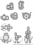
Burial mounds are a staple of fantasy games and stories. Today’s offering is a collection of nine different burial mounds for those occasions when you really need to loot a a small tomb right now.

The four lower tombs have Greek “Dromos” entrances – an “avenue” cut into the barrow hill leading to the door to the tomb itself. These avenues would be built up in stone to hold back the earth of the mound and to provide a clear route to the door. Often the end of the dromos furthest from the door would be decorated with columns or other decorations, often long gone by the time would-be tomb robbers arrive on site.
 

baraloba-hex-6.png

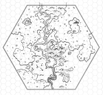
To the south of Baraloba are the Eagle Hills and the imaginatively named Eagle Hills River that runs through it from south to north before joining the Hewbank. The Eagle Hills have a mix of chalk and coal deposits that were attractive to miners. Most of the deposits have now been worked, leaving a collection of open mines and shaft mines in the area. The central point of interest in this hex is the old open chalk mine that takes up 11 of the subhexes right in the middle of the map. The hills here are bright white and are a mix of natural hills and tailings from the mining operations.

On the opposite side of the river and small lake from the mines is a boggy marshland slowly being reclaimed by the forest. If one were to dig beneath the immediate mud and water, it would be noted that the reason this area is low and doesn’t drain properly is that it too was an open mine at some point.

Further south along the river is a small drift mine that has become home to a modest group of humanoids. They keep a low profile and farm the area around the minehead, using grain stolen from caravan a decade ago as their original seed stock. There are less than a score of them living here and they take significant pains to not be noticed by the residents of Baraloba only seven miles away.
 

baraloba-hex-7.png

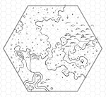
Southwest of Baraloba, the Eagle Hills continue into heavy forests. The closest thing here to Baraloba itself is yet another of the old giant’s watchtowers – although this one is not as decrepit as most of the other ruined towers in the region. A druid and their apprentice maintain the tower and keep a small herd of goats that keep the grass in the hills and vales of the area nicely clipped. A trail leads from the tower into the woods and to a massive tree in the middle of a clearing where the druids perform their rites and occasionally just engage in silent contemplation.

A little further to the west another trail leads through the woods to a very large farm / small farming community. A couple of large multigenerational families run these farms and generally try to be self-sufficient, only walking to Baraloba when they require supplies they cannot find or make on their own or with the help of the druids in the tower. The rest of the hex is unpopulated wilderness – rolling hills and a few jutting chunks of stone, expanses of dark and heavy forest teeming with wildlife, small bubbling brooks, and a lazy river looping gently through the hills.

baraloba-assembled-7.png

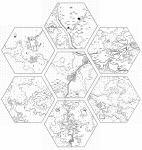
I've also included the full set of seven hexes to show how they fit together. On a normal 6-mile-hex map these would be a village hex in the middle with (clockwise from the top) badlands & ruins hex, hills hex, forest hex, hills hex with mine, forest hex, forest hex.
 

Remove ads

Top