I draw the occasional D&D map

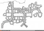
Basilisks-Caves-Web.png

Travelling along the edge of the Dry Badlands of Korush en route to the City of Copper Bowls, you find half of the corpse of a young man clutching a small dragonhide sack containing the emperor’s emblem – a courier. The trail of blood leads from the body back into the Basilisk’s Caves…

Many know of the Basilisk’s Caves because of the tale of the ancient archmage Brasorin Zijes who’s petrified form was recovered from the badlands some eighteen hundred years after his petrification. Once he was extracted from the Basilisk’s Caves and de-petrified, he was a great source of information for sages seeking information about his era – until he was slain one again when he decided to try to take over the empire.

The Basilisk’s Caves are a mix of natural and partially-worked caves and galleries cut into the face of the Falleck Promontory overlooking the Dry Badlands of Korush. Mostly ignored these days except when a storm blows through the area forcing travellers to seek cover herein.

One of the deeper galleries (the rectangular one on the lower right with a single pillar within it) has a wide natural stone chimney opening to the surface cut by floodwaters which occasionally floods that chamber, the next gallery to the left, and then the passages along the bottom of the map to the entrance when the rains bring floods down through the promontory to water the Dry Badlands of Korush every two to four years.
 

log in or register to remove this ad

Jhaelen

First Post
The Basilisk’s Caves are a mix of natural and partially-worked caves and galleries cut into the face of the Falleck Promontory overlooking the Dry Badlands of Korush. Mostly ignored these days except when a storm blows through the area forcing travellers to seek cover herein.
Wow, that's a really cool map. I love that all the hallways are at odd angles making it really hard to map for the would-be explorers.
 

My-Private-Jakalla-Map-1T-Grid-Patreon.jpg

Another month of exploring the undercity along the riverbank, just south of the Palace of the Realm, and we again find ourselves in basement ruins that were not entirely filled in during the Ditlana but were sealed off and built over as sewers were built to take their place.

The most remarkable element of this part of the map is a great hall that is now cut into three parts that is in turn connected to what appears to be a partial duplicate of a temple understructure just south of here (in map 1O). Most of the hall is in quiet rotting ruins, connected to the old passages along the sewers in 1R. All of these sections were parts of the temple 400-500 years ago.

The westernmost section of the old great hall has been stripped of all religious iconography and some of the walls have even been replastered to keep the moisture out. A secret door connects to the sewers here and the hall is used as the meeting place for a secret society who’s members enjoy the irony of operating out of the hall that was once part of the temple that seeks their destruction.

Accessing this map requires either coming down the stairs to the sewer access and maintenance chamber on the north side of the map (the chlen hide bars here are locked to keep out intruders, but many copies of the key are now in circulation), following the same sewers from their source in map 1N, or coming in through the sewer tunnels in 1R.

(The connection map I use for this is too large for the forums, but can be seen at the blog post at https://rpgcharacters.wordpress.com/2018/02/28/my-private-jakalla-map-1t/ )
 

WEB-Heart-of-Darkling-the-Hags-Patreon.png

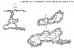
We have travelled down the Darkling River to finally arrive at the Darkling Lake – an underground lake of immense size that was once home to a thriving society of aboleth slaves and a few ancillary groups until a new aboleth arrived and slaughtered them and their master.

This small cove stands out from the other random coves along the lakeside because of the three bronze statues of long-haired women who reach out in supplication to travellers along the water. Each reaches out with one hand, while another hand remains behind them – the hidden hand either holding a long serrated blade or adorned with wicked long nails. The backs of the statues also show the women as deformed and twisted – thus the cove’s name as “the Hags”.

At one point, a river emptied into the Darkling from this place, and the old river cave can be followed up on the left side of the map until it collapses in on itself.

The main point of interest at the Hags, other than the statues themselves, is a small structure built into the cave wall here. Within the structure is wide well that descends to unknown depths and that is filled with the most foul sulfurous and slimy liquid. Shamans of the Darkling and neighbouring areas come here to imbibe the waters of the deeps and hallucinate while under their effects – seeking visions and omens and their spirit guides. Not all survive the poisonous drink, an not all travel here with companions who bring their bodies home, thus the Hags is also home to many a skeleton of these shamans of the deep, and perhaps a few of them linger on as undead.
 

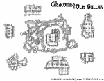
WEB-Catacombs-of-Olik-Gullar-Patreon.png

Since the Day of the Green Sun three weeks ago, the catacombs of Olik Gullar have been teeming with the undead. A sanctified necropolis, Olik Gullar contains untold numbers of the dead from the city above. The catacombs have been locked down now, but some worry that it is only a matter of time before the restless dead claw their way through to the cobbled streets of the city proper…

This map is a “proof of concept” of what I wanted a few earlier catacomb & sewer maps to look like. I just didn’t have the skill at the time to pull it off. I drew this on a single page, with the two different scales for the overview and callouts – although I ended up moving the callouts a bit in photoshop afterwards because they were a bit cramped in some places and sparse in others.

In the end I’m very happy with the resulting mix of scales, and am proud to release the Catacombs of Olik Gullar to you.
 

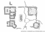
WEB-Toronin-Ruins-Surface-Patreon.png

With the town of Toronin razed to the ground, the ruins of the small fortress are all that remain to indicate where the town was these days.

The mossy ruins have a few streams that wander through them to a small pond in front of what was some sort of memorial wall. The massive 30-foot block of stone is badly damaged, but it is clear that it once had carvings on it, including what appears to be the back end of a lionine beast and a helmeted form bearing a great spear.

While most of the structure is in ruins and the roofs fallen in – there remains two access points to a small dungeon beneath the ruins that remains in somewhat better shape despite the years.

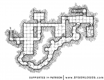
WEB-Toronin-Ruins-Underground-Patreon.png

The dungeons in turn are made up of two levels – the worked dungeons and a smaller cave beneath. Some stone work is evident in the smaller cave, but the area was never completed because it often floods when water levels are high, and there is no easy way to remove the water that accumulates down below. One room on the eastern edge of the dungeon is also cut down further into the rock (and was used as an actual dungeon) and suffers from this same wetness resulting in it being almost completely covered in a thick slime mold.
 

fantasyclipinks

First Post
I love your work, my fellow canuck. These maps are so clean and crisp, even though by adding the little rocks and rubble to form the grid lines, they are still so easy to read and write on.
Nice stuff.
WM
 

I love your work, my fellow canuck. These maps are so clean and crisp, even though by adding the little rocks and rubble to form the grid lines, they are still so easy to read and write on.
Nice stuff.
WM

Thanks!

And yes, one of the reasons I work in B&W instead of colour is the ease of annotation.

labour-day-prep-closeup.jpg
 

WEB-The-Strike-Patreon.png

They call it "The Strike", the place where a massive longsword of a magical material sits embedded in the stone, surrounded by a small crater. Over the years a small church and a few buildings have been built up around the strike, and a temple dug underground where the faint glow of the magical material can be seen. Some come down here to establish their vows as paladins, others to take in the essence of the blade to supposedly increase their martial prowess.
 

WEB-Troll-Hole-Patreon.png

On the western edge of the Swamp of Forgotten Dreams, the stony roots of the Highspear Mountains are exposed right down to the waterline of the swamp. Most fear to travel on this side of the swamp because of tales of trolls that seem to crawl right out of the mountains. This Troll Hole is home to a few such loathsome creatures – a small stone chimney that reaches down at least a hundred feet to damp caverns below. Water still dribbles down the chimney, a constant rivulet that the trolls drink from. But don’t make a sound here, for what comes up the chimney is far more ferocious than smoke – troll after troll seem to just explode out of the top of the chimney as they climb out seeking prey.
 

Split the Hoard


Split the Hoard
Negotiate, demand, or steal the loot you desire!

A competitive card game for 2-5 players
Remove ads

Top