Jürgen Hubert
First Post
I thought it might be of general interest to start a Cartography Workshop thread - a thread where we can explain techniques we used to create our maps.
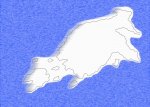
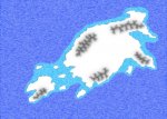
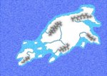
I will start with a few techniques of my own - specifically, the techniques I used to create this map. But I want to stress that I am not pretending to show the "one true way" of creating maps - in fact, I am a relative beginner, and I am sure that there are many ways of doing things better! If you have suggestions for improvements, or different ways of doing things, jump right in and tell us about it! This is a workshop, not a tutorial, and I want this to be as much for the improvement of my cartography skills as for yours.
But first a few words on the tools I used.
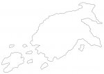
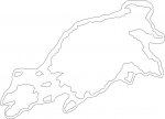
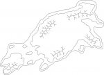
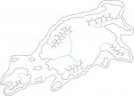
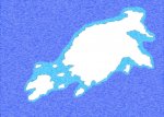
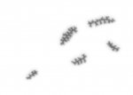
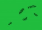
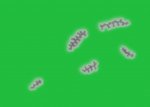
For line drawings - for basic outlines of continents, rivers, mountains etc - I use Inkscape. Inscape is a vector-based graphics program, meaning that if you want to change the map scale later on or move minor details around, you can do so easily without lots of minor editing to prevent weird image artifacts. I also use Inkscape to place the location of cities and similar small details - this allows them to be moved around easily.
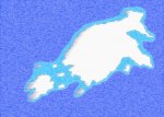
For filtering effects - to give the map color details and special effects - I use GIMP, which is a bitmap-based graphics program in the veins of Photoshop, which you might be more familiar with.
Both of these programs are Open Source and freely available for a number of platforms, so you can repeat all of those steps by yourself.
Another tool, while not strictly speaking neccessary, is still something I highly recommend: A graphics tablet. These handy little devices will make drawing lines a lot faster. I recommend a Wacom tablet because they have pressure sensitivity (though you won't need it for what follows, that's still a nifty feature) and because they are simply the best on the market.
I will start with a few techniques of my own - specifically, the techniques I used to create this map. But I want to stress that I am not pretending to show the "one true way" of creating maps - in fact, I am a relative beginner, and I am sure that there are many ways of doing things better! If you have suggestions for improvements, or different ways of doing things, jump right in and tell us about it! This is a workshop, not a tutorial, and I want this to be as much for the improvement of my cartography skills as for yours.
But first a few words on the tools I used.
For line drawings - for basic outlines of continents, rivers, mountains etc - I use Inkscape. Inscape is a vector-based graphics program, meaning that if you want to change the map scale later on or move minor details around, you can do so easily without lots of minor editing to prevent weird image artifacts. I also use Inkscape to place the location of cities and similar small details - this allows them to be moved around easily.
For filtering effects - to give the map color details and special effects - I use GIMP, which is a bitmap-based graphics program in the veins of Photoshop, which you might be more familiar with.
Both of these programs are Open Source and freely available for a number of platforms, so you can repeat all of those steps by yourself.
Another tool, while not strictly speaking neccessary, is still something I highly recommend: A graphics tablet. These handy little devices will make drawing lines a lot faster. I recommend a Wacom tablet because they have pressure sensitivity (though you won't need it for what follows, that's still a nifty feature) and because they are simply the best on the market.