You are using an out of date browser. It may not display this or other websites correctly.
You should upgrade or use an alternative browser.
You should upgrade or use an alternative browser.
Near East Maps
- Thread starter shivamuffin
- Start date
shivamuffin
First Post
Another Map
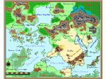
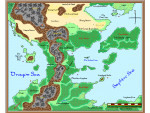
Another map in the FR style. I prefer to use the standard black dot to show where cities are located. I haven't mustered up the courage to place roads yet...They seem to foul up the map. I also need to play around with different water depths.
So far this is what I have, and it seems to print off well. This particular version is a PNG file, so please excuse the graniness.
Attachments
shivamuffin
First Post
Some of the symbols I have created and submitted to ProFantasy ( The makers of CC2 ). Some of these can be found at their website.
Currently these are the projects I'm working on:
1. Many requests for Greco-Roman overland, city, and dungeon symbols.
2. Mideastern overland symbols ( Villages, towns, and cities, as well as Wonders of the World, and ruins. )
3. People! citizens to populate cities and dungeons.
Currently these are the projects I'm working on:
1. Many requests for Greco-Roman overland, city, and dungeon symbols.
2. Mideastern overland symbols ( Villages, towns, and cities, as well as Wonders of the World, and ruins. )
3. People! citizens to populate cities and dungeons.
Attachments
Magistus71
Explorer
Re: Another Map
These are some nice maps. What format are the symbols in?
shivamuffin said:Another map in the FR style. I prefer to use the standard black dot to show where cities are located. I haven't mustered up the courage to place roads yet...They seem to foul up the map. I also need to play around with different water depths.
These are some nice maps. What format are the symbols in?
shivamuffin
First Post
.FCW ( Fast CAD )


